A big decision dropped from the Land Planning Appeal Tribunal (LPAT, formerly the Ontario Municipal Board) this week. It is a key part of an ongoing saga over the Rail Deck Park, which is exactly what it sounds like: a park decked over a railway, in the heart of western downtown Toronto.
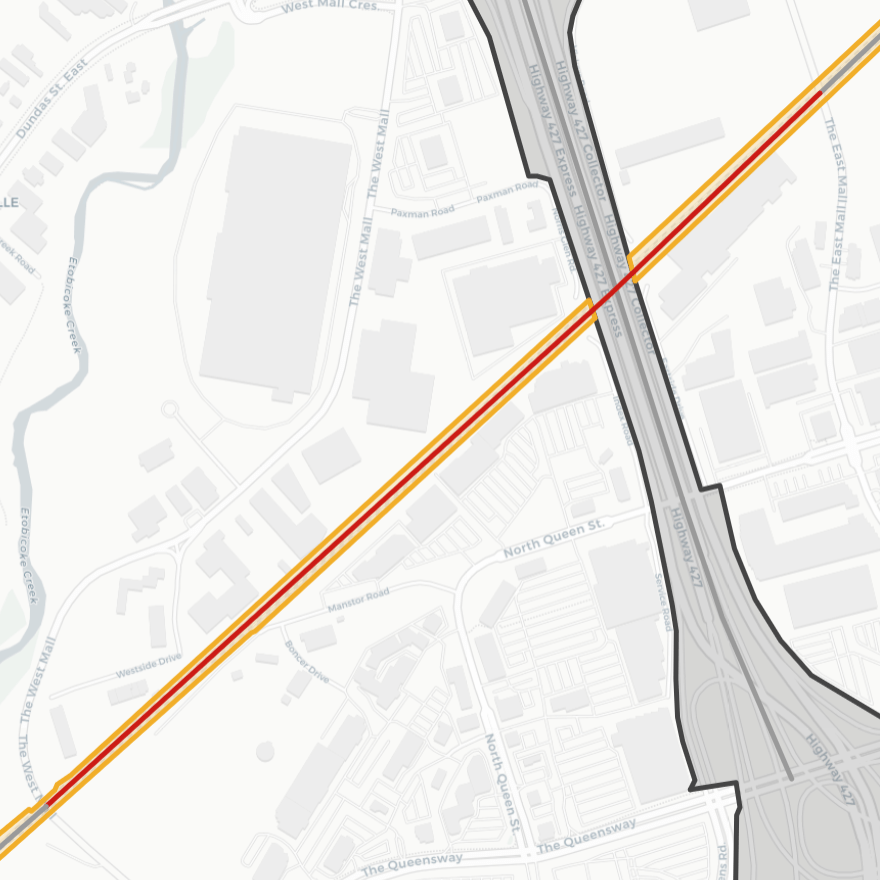
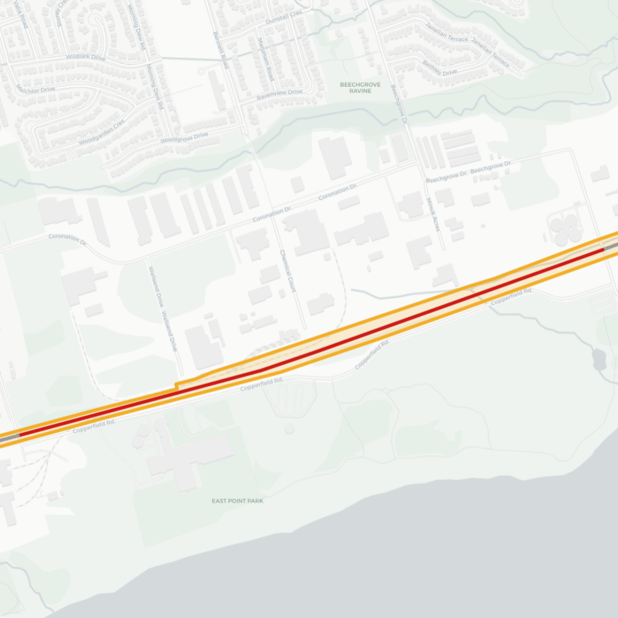
More specifically, it’s two competing visions for a deck over 7.5 hectares of airspace above railways tracks northwest of the SkyDome: one by the City (herein referred to as Rail Deck Park) where pretty much all of it is parkland, and one by a private developer called CRAFT (the Over Rail Corridor Area Project, herein referred to as ORCA Project) where one third of the site is mixed-use development, and the remainder is parkland.


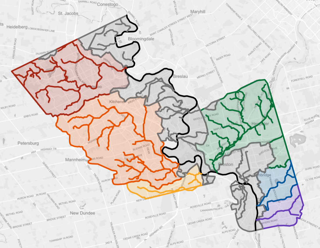
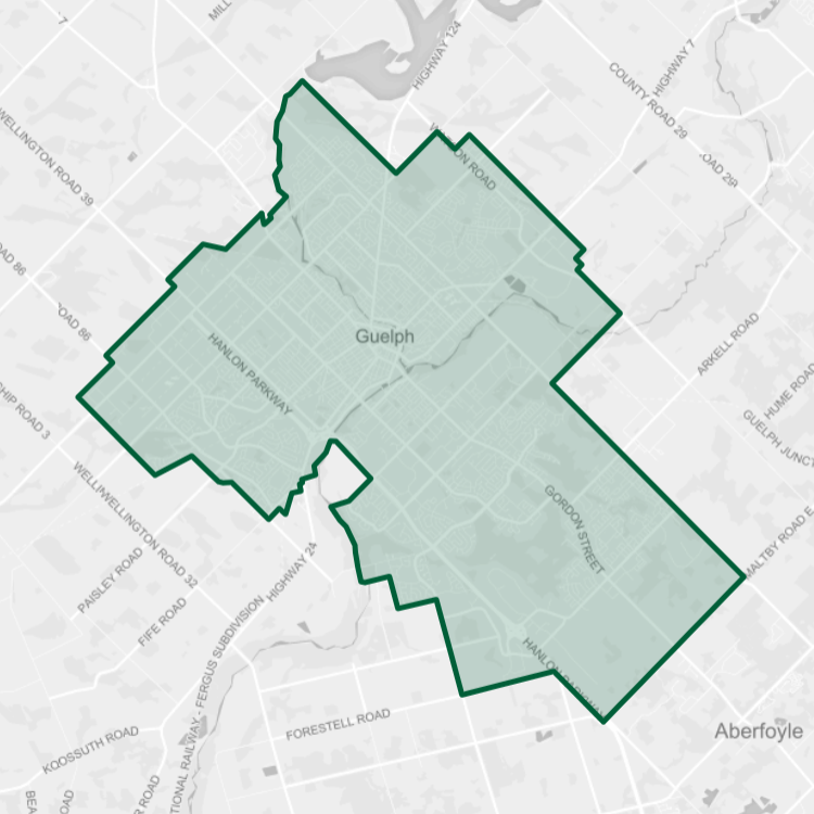
Top: Rail Deck Park (Courtesy City of Toronto)
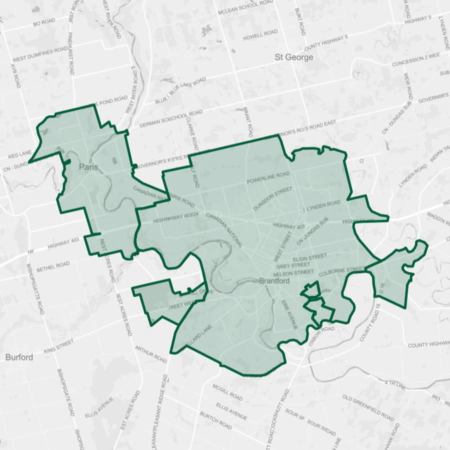
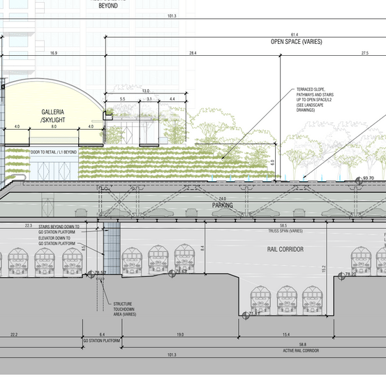
Bottom: ORCA Project (via the LPAT Decision)
From what I’ve seen in the hours that have passed since the news dropped, this LPAT decision has divided those watching the saga unfold. Some are upset and disappointed Rail Deck Park is headed for the trash can. Others are seeing this as still being a win, with a sizable park still in the mix.
I’m in the latter camp, and I want to dive deep into why. It’s not a matter of settling for less, in my view, but being more efficient with parkland acquisition.
Background
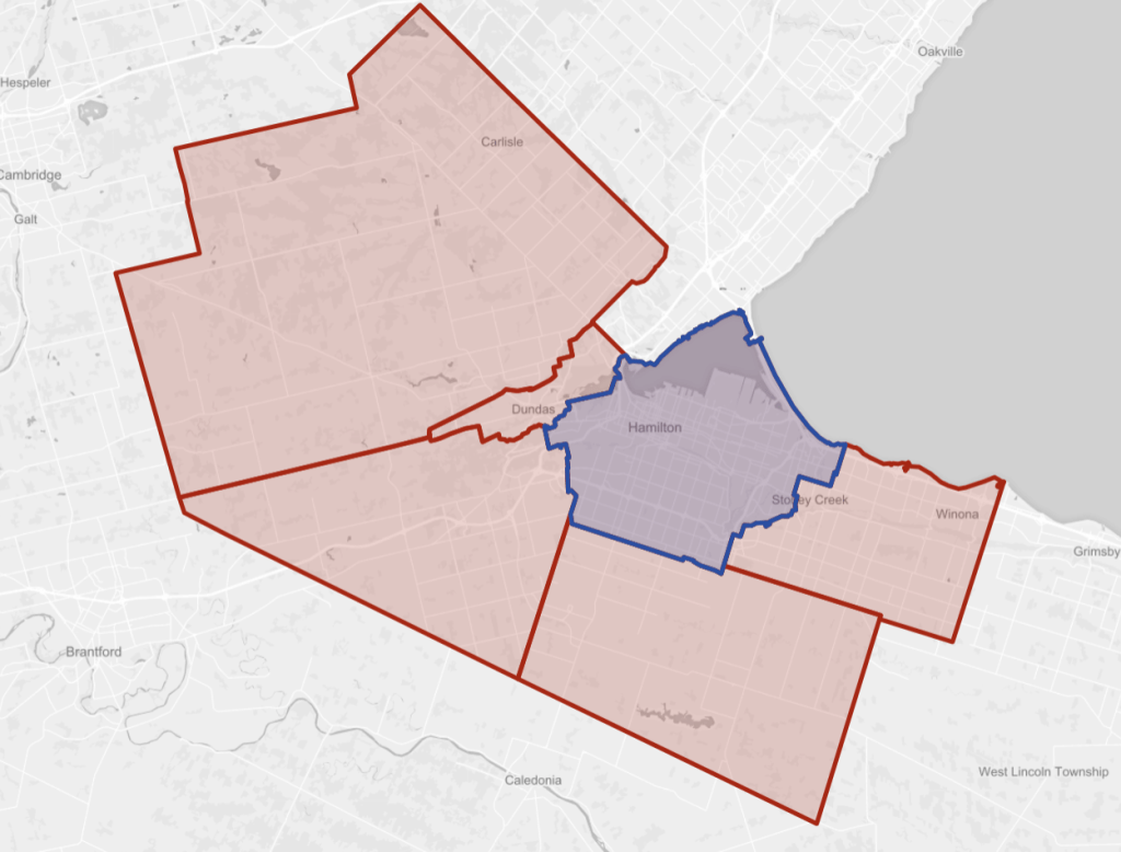
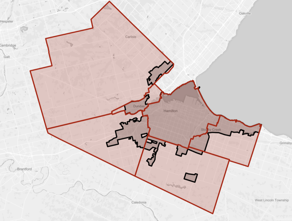
This park is proposed over a western part of the Union Station Railway Corridor, a large conduit for trains between Union Station and major destinations to the west, including Pearson Airport, the southwest and northwest GTA, Wellington / Waterloo, Niagara, and the rest of southwestern Ontario. It is a shadow of the freight rail yards that once were, it is the artery to the busiest transportation hub in Canada.
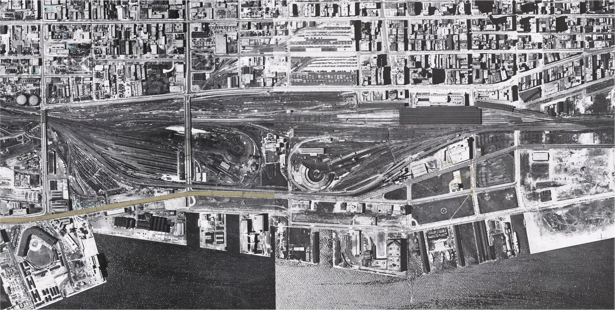


It is also home to the North Bathurst Yard, where GO Transit trains assigned to make rush hour trips into (AM) and out of (PM) Union are stored during the late morning / early afternoon. It’s important too, as such yard space in downtown is a premium, and it’d be hard to find similar space without running trains further away. That could mean more operator time and energy (diesel or electricity) spent, and possibly conflict with other train movements.
Such a vital corridor needs to be protected through construction and maintenance. It’s also huge: 7.5 hectares (not including the existing park strips on the south side). This means building a deck of any sort will be a costly engineering and design challenge. But being on top of this conduit for so many people provides an incentive to develop.
The Central Park Problem
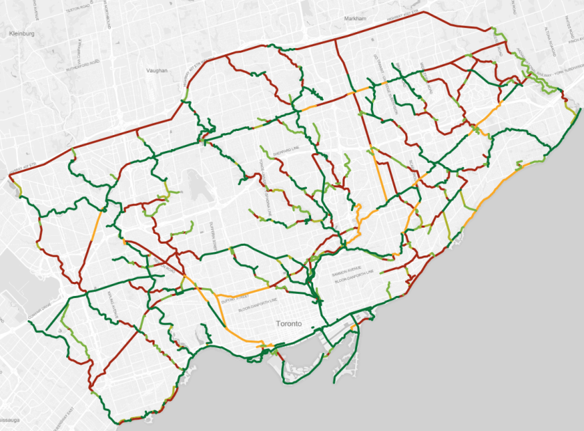
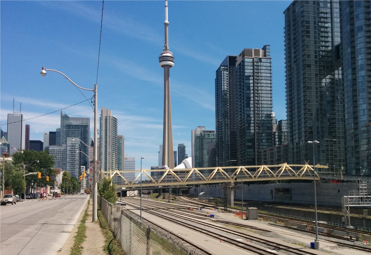
This rail corridor is a large void in the downtown core, smack in the middle of CityPlace and The Well, two major developments that have brought almost 10,000 residential units and a million square feet of office space to the area. On top of that and other recent growth in the area (e.g. Liberty Village and Ordnance Triangle), another 140,000-180,000 units are projected to arrive in the downtown core in the next 20 years. The void presents a major barrier to movement between the north and south sides. The Pente de Luz pedestrian bridge, situated between Bathurst and Spadina, has improved things. More broadly though, it’s also in one of the most park-deficient areas of the city per-capita.
This is what has brought things to a head on this site: should the City take on making all of the space parkland through Rail Deck Park, or allow the CRAFT Development to use some of that space for mixed-use buildings in exchange for sharing the costs?

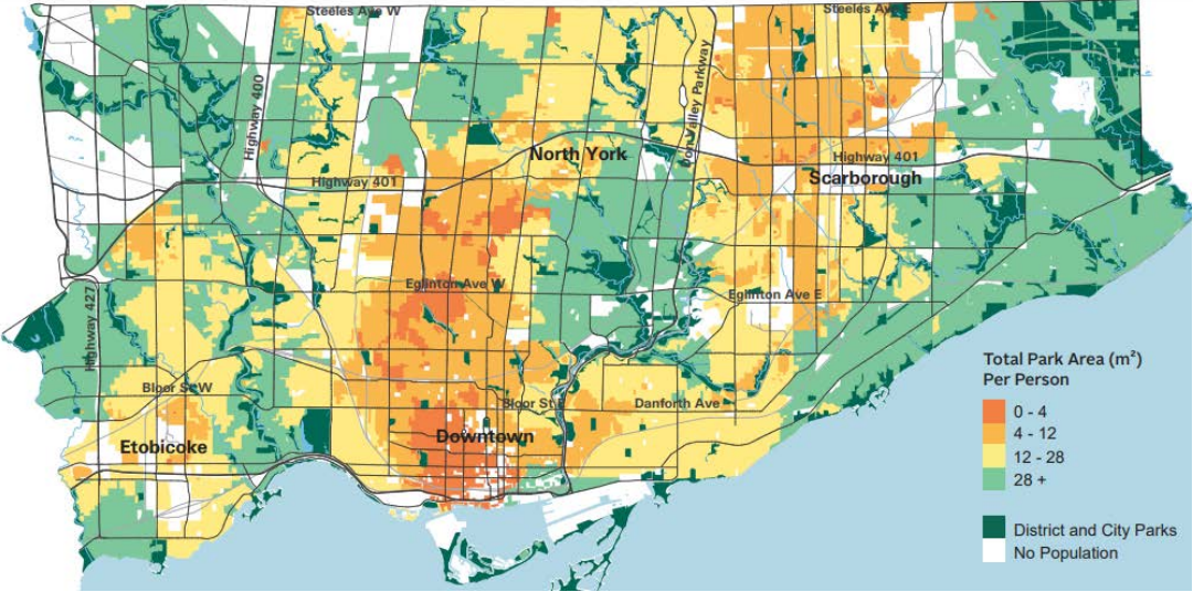
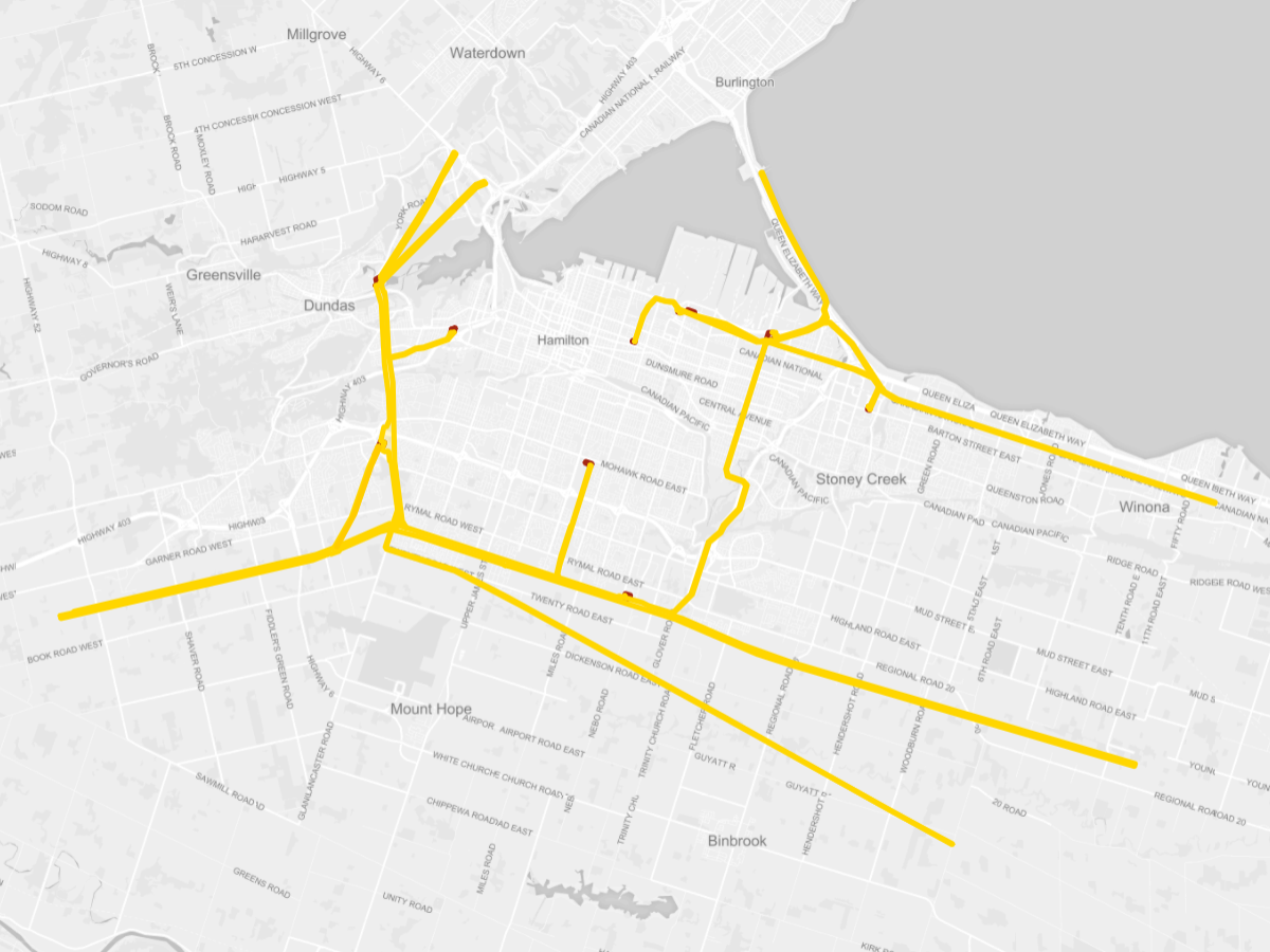
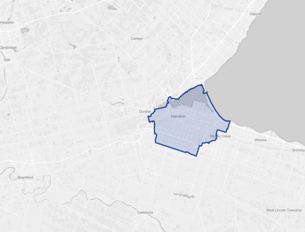
Illustration of downtown park need. Courtesy of the City of Toronto
It comes down to priorities, and for the most part, it’s been framed as a choice between the need / value of that additional parkland, versus the costs to the City.
Obviously, the City believed making 100% parkland was needed, but Rail Deck Park seemed to be rushed to get ahead of the ORCA Project. A cynical person may buy into the rumor that this was pushed to be John Tory’s political legacy.
That aside, my background is in economics, so I always look at issues in our natural and built environments with an ‘opportunity cost’ lens: if we put time and money towards one thing, what do we lose by not putting that towards other things?
Costs
To fully consider the cost of parkland, you need to look at the money you have to spend, in addition how much a park will cost. You also need to consider two categories of costs: capital (building) costs, and operation / maintenance costs.
In 2015, a Spacing magazine piece estimated the the parkland funds for 3 of the former major downtown wards was around $140 million, which has likely grown with 5 additional years of development and inflation. Mind you, 100% of those funds don’t have to go to the park, as money could potentially be cobbled together from other general City revenue, development charges on future developments, and/or funds from the provincial / federal government.
And that additional money will be needed. Early capital cost estimates for Rail Deck Park done in 2017 were around $1.7 billion, which dwarfs the fund. That’s a huge outlay of money for one park. In fairness, that’s in the rough ballpark of buying land for parks in downtown Toronto, which was estimated up to $115 million per hectare. But this does not capture operation and maintenance costs or any liability for a deck over a rail corridor.
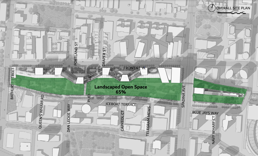
With some of the parkland taken away through the ORCA Project, we’re still left with 4.9 hectares (65%) of net new parkland. A great share of the fixed capital costs could mostly be borne by CRAFT, with ownership of the park conveyed to the City. Isn’t this an efficient outcome, obtaining all that parkland at a fraction of the cost?
The opportunity cost here, according to the City and other proponents of Rail Deck Park, is that you’re never going to really get an opportunity to make such a large contiguous park in downtown Toronto ever again. I can understand some folks would place a high value on that and say the cost is worth it. But is that statement actually true?
Possible Parks
It bugs me that the City’s framing of this as a “now or never” opportunity has gone relatively unchallenged.
First off: what about the rest of the rail corridor? I imagine that some air rights have already been sold off elsewhere, such as at CIBC Square (which is already becoming a small rail deck park) and around the Metro Toronto Convention Centre. But what about outside of that? East of Union Station? Bathurst to Strachan? What if we tore down parts of the East Gardiner? Linked up with the future East Harbour transit hub? These are undoubtedly opportunities that offer the same proximity and, stitched together, could theoretically add over 30 additional hectares of rail deck parkland stretching along the 5 kilometre corridor.
Going a bit outside of that proximity, there are also some other major sites we should be looking at.
- Exhibition Place and Ontario Place are flexible spots due to vast surface parking lots, but the opportunity cost here is inactive dead space for much of the year. This could easily be parkland, and there could be steps taken to keep it flexible for events like The Ex, indy races and other fairs.
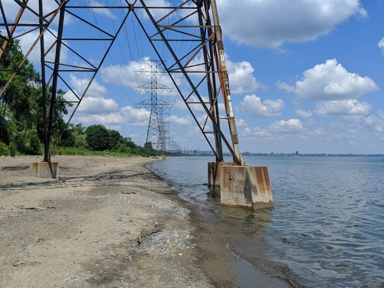
- Matt Elliott recently made the case for shutting down Billy Bishop Airport. I agree, and much of my support for closure is because a) we should be working to transition more short-distance flights to improved and more sustainable rail service, and b) it’s a huge opportunity to create more housing, additional parkland, and/or improved access to the Toronto Islands as a whole.
- The downtown mainland is all built on landfill. We could theoretically continue to build out. I understand boating is a big part of the harbour’s history, but outside of the public ferry, it’s fairly exclusive to those who can afford to own, maintain and dock a boat, or shell out to take part in a cruise. I believe infilling of some of the harbour, accommodating limited boats in the core shore, and shifting the rest of the activity out is a fair goal to pursue.

These three opportunities alone account for anywhere between 13 and 130 hectares of potential parkland. And altogether, with the additional rail decking, this is 170 hectares pf potential parkland. It represents over 20 times the land available for Rail Deck Park, and over 60 times the land area sacrificed in the ORCA Project.
As sweet of a dream that is, it’s only a conceptual exercise, and I’m not proposing each or all of these proposals becoming parkland. I’m merely illustrating a point: if you have almost $2 billion you’re willing to spend on a large continuous piece of parkland for downtown Toronto residents, there’s tons of opportunities on both public and private lands, and you very well may get way more and/or parkland for your buck.
Function, Quality and Benefit
I emphasize better: some of the opportunities above are on solid ground, possibly making better quality parkland. A Rail Deck Park will be a sort of artificial elevated strip of fill. This introduces a challenge of managing the health of the soil and terrestrial vegetation, protecting it against contamination and over-/under-saturation while ensuring it’s not impacting the deck structure or the tracks below.
This could be challenging and expensive to manage on a large scale, at least relative to parkland on solid natural ground.
Also consider the potential ecological benefits on the other large sites listed above. Taking away parking lots from Ontario Place and The Ex provide more opportunity for rainfall infiltration and reduce urban heat island effects. Converting the airport into parkland could compensate for recent island shoreline erosion and eliminate impacts from noise and deicing. Infilling the harbour could create a softer shoreline and possible aquatic habitat enhancements.
And all sites can provide stable, rich ground for trees and other vegetation. Overall, it just seems like you have an opportunity to manage richer, more passive parkland.
Looking Forward
The last key point in all this is it isn’t over. This was a rejection of the City’s attempt to block a development proposal at one of the highest levels of planning. CRAFT still has a long road to go down, from the still broad strokes of height and massing, to the fine details of grading and fees.
The City will have to give up 2.6 hectares a park here, but can still gain another 4.9 hectares. They can now embark on negotiating with CRAFT to realize their vision for the site to the extent possible, and negotiate on the share of any costs (with additional opportunity to provide extra development potential for cash-in-lieu). Make ’em pay.


But don’t stop there. As far as I’m concerned, the City publicly committed almost $2 billion worth of parkland to downtown Toronto residents and workers. They should stick with that commitment. Take the balance of whats left over from any deal with CRAFT, and put it towards other sites. I’ve provided some examples.
There’s always opportunities to make our parks and public spaces bigger and better. You just need the courage to keep pursuing them.