2018 marks the first full year of #metroscapes, a brand I launched in November 2017 to organize the hundreds of kilometres of hiking I had done in Toronto, and to represent their theme: the exploration of where natural and built environments collide. And with this new brand, I started upping my game. I started planning my walks, making them less of aimless wandering and more of discoveries of natural systems and built corridors. I started pulling from additional resources, such as the City of Toronto’s mapping service and historic aerial photographs. I migrated this website to a new platform to expand beyond walks, and have dedicated pages for projects such as #shorelineTO, #neighbourhoodsTO and Toronto’s Trail Network. And although this website now shifts some focus away from blogging, I still use it, with a new practice of using it to comment on public documents such as the City of Toronto Parkland Strategy and the Toronto and Region Conservation Authority’s Trail Strategy for the Greater Toronto Region.
So it’s been a good year. I am extremely satisfied with how things have shaken out. The entire experience feels richer, easier to share and keep updated, as well as resourceful for fellow Torontonians, expats, and other followers.
So with that, I decided to conduct another year-in-review, similar to what I did for 2017 (it appears that blog post didn’t survive the migration, perhaps a retroactive rewrite is in order). I will go over the stats, the neighbourhoods and watersheds covered, and highlight my favourite shots from the year.
Statistics
2018 was the year that I surpassed what I had walked (and tweeted and recorded) in the prior 21 months.
- Over 40 walks, I travelled 557 kilometres (km), the equivalent of driving from Toronto to Montreal.
- The average walk was 13.9 km, about the same distance along Yonge Street from Sheppard Avenue to the lake.
- The longest walk was 23.2 km (May 5), or almost the distance between Kipling and Warden subway stations.
- There was lots of variation month-to-month as well; one walk early in August (when I usually take vacation, but was expecting my child this year), and 100 km over 7 walks in February.
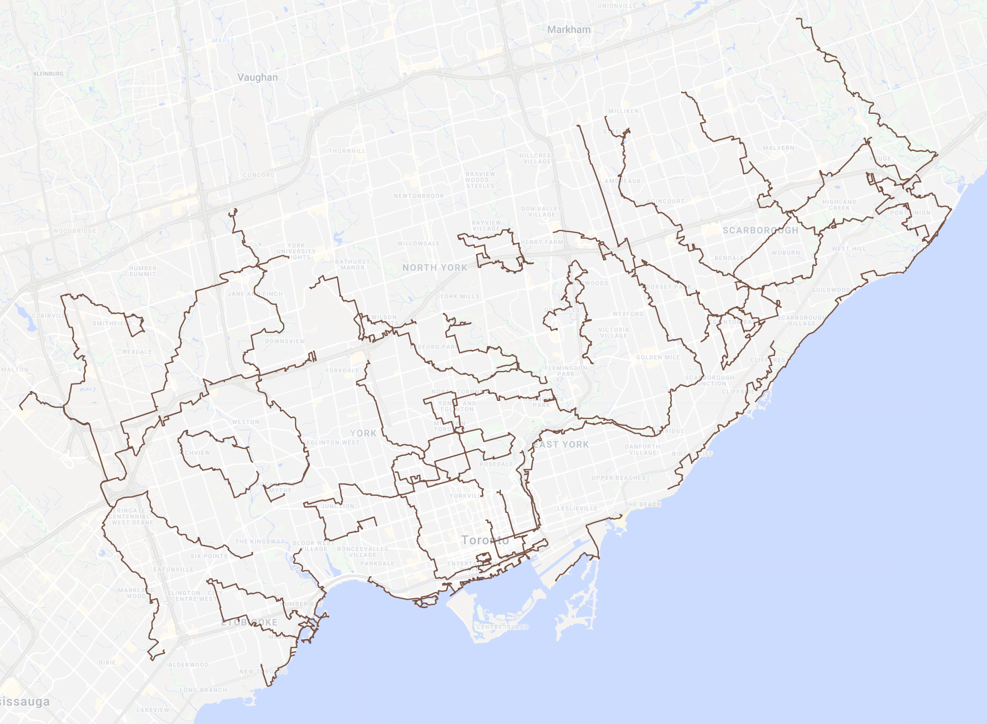
Neighbourhoods
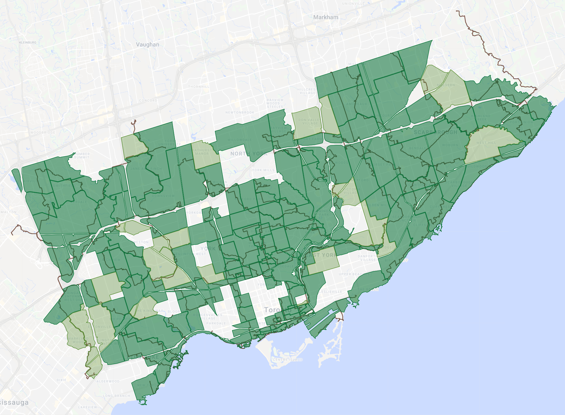
There were 166 neighbourhoods covered in 2018, 143 of them which were truly walked through, up from 120 and 80 last year, respectively. Good broad coverage of the city, and Scarborough in particular was blanketed pretty well. Walks in Toronto-East York mostly avoided the downtown core, sticking to East York, the shoreline, and west end. 6 walks went beyond the City of Toronto borders, 3 of them in the Pearson airport area.
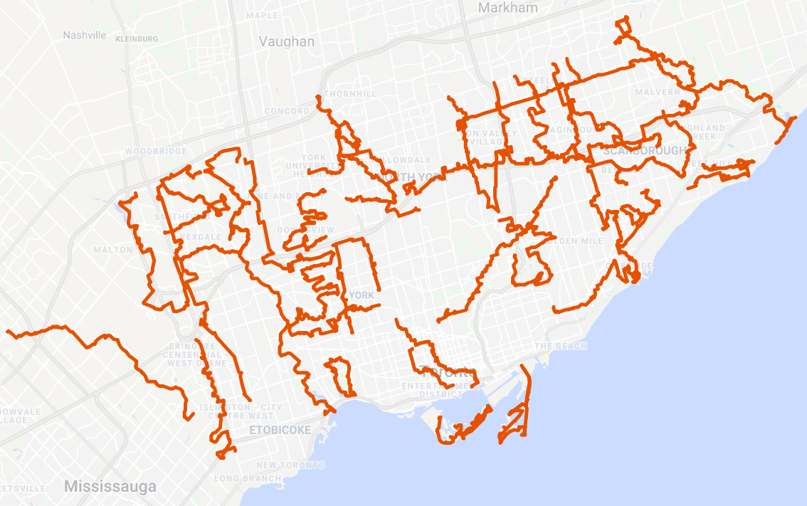
Watersheds

Last year, I covered all watersheds except for Mimico Creek. I was able to rectify that this year, covering all watersheds in Toronto.
- I covered most of the first-order rivers and creeks of the 7 main watersheds, with the exceptions of the East Humber and the Rouge River.
- 20 second-order or lower streams were followed, ranging from major tributaries such as Black Creek or Taylor Massey Creek, to small semi-lost tributaries such as Vyner Creek or Silver Creek.
- 7 lost rivers were traced. Two drain straight to Lake Ontario, one was a tributary of Mimico Creek, two were Lower Don tributaries, and two were tributaries of West Highland Creek’s Dorset Branch.
Looking to 2019 and Beyond
It’s been nearly three years since I started tracing and tweeting Metroscapes walks, and that has resulted in over 1,000 km of walks in total. That also means I’ve covered many of the neighbourhoods and watercourses in Toronto. That doesn’t mean I am in short supply of places to see. As I mentioned at the top, I have been planning my walks, and that means there is plenty of goals set for 2019:
- Three major watercourses: Upper West Don, the Lower Humber, and the Rouge River.
- Major destinations: The Islands and the Leslie Spit.
- Numerous tributaries of the Humber, Don and Highland.
- Exploring the edges of Toronto’s highways and railways.
If I was still able to walk every weekend, I could probably achieve all the walks I’d like in 2019. However, I need to prioritize: I’m now a father with limited free time, and 2019 may be my last year in Toronto.
But this will not be the end of Metroscapes. In fact, it will be an opportunity to expand the brand to the next city/region I call home, and to other cities as well. Stay tuned, and keep exploring your local metroscapes.
