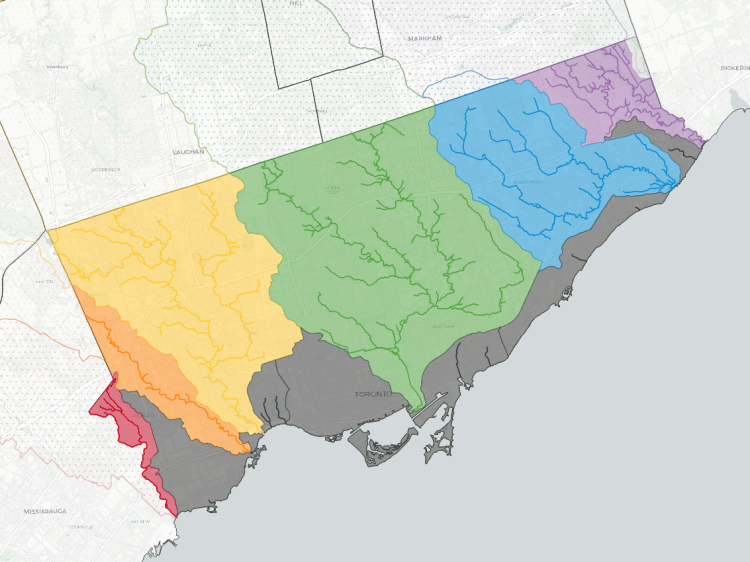
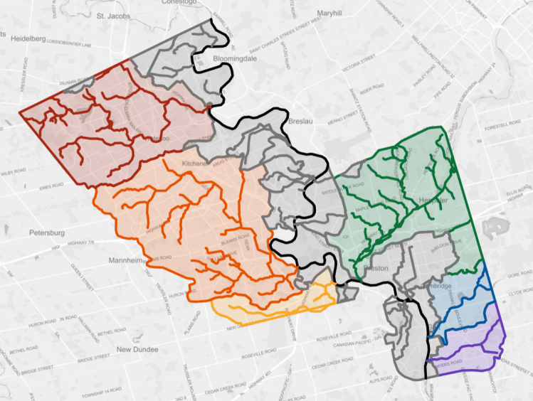
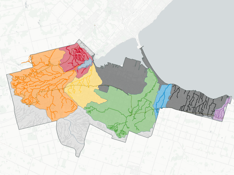
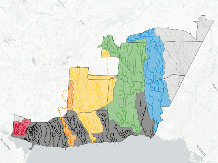
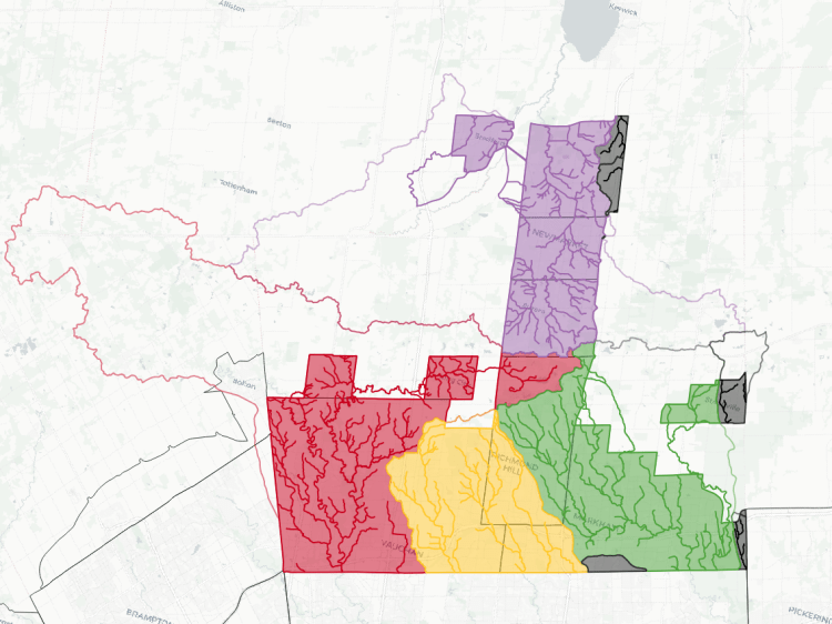
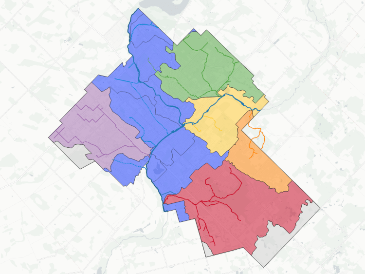
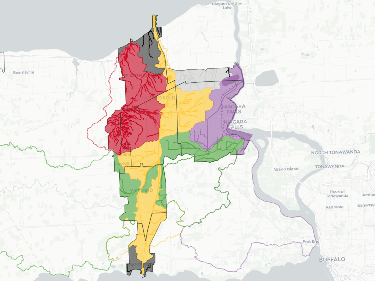
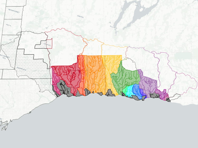
Mapping watersheds is usually a task reserved for municipalities and conservation authorities, with the goal of restoring or enhancing its health. I started mapping Toronto’s watersheds as a way to plan my walks, understand their extent and reach, and catalogue the common names attributed to smaller tributaries.
Mapping a watershed can also show what opportunities there are to establish great active transportation corridors. Some are “lost rivers”: watercourses that were buried, either without a trace, or leaving mysterious scars in the urban fabric. Some are existing ravines that simply are inaccessible, overgrown, or privatized.
Municipalities and conservation authorities usually provide very detailed GIS maps of every shed and watercourse, and/or broad scale static maps of the sheds and the largest watercourses only. These maps are something inbetween, to help provide some insight as to what watershed you’re in, and hep you follow along as you explore your local metroscapes.