Waterloo, Kitchener and Cambridge. The Tri-Cities. These three cities are basically one urban conglomeration of over half a million people, and it is where I began the second chapter of #metroscapes. After 5 years of exploring Toronto, this is where I began to discover how urban fabric varied between areas depending on the age and density of development.
Check out the links below to learn more about the Tri-Cities.
Projects
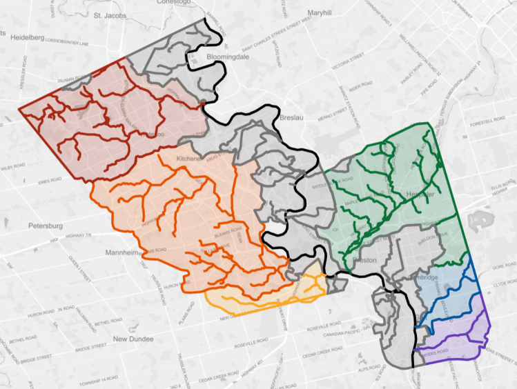
A map of the 6 major watersheds and other interstitial drainage within the urban boundaries, as well as the watercourses within them.
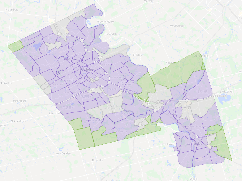
A map of the 200+ neighbourhoods, districts and greenfield areas of the Tri-Cities.
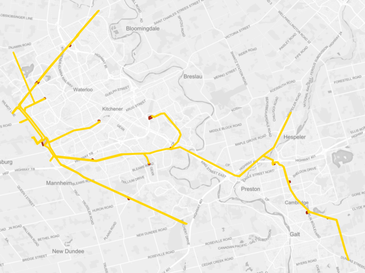
A list of the Tri-Cities’ 12 hydro corridors.
