Toronto is in the midst of drafting its 20 year Parkland Strategy, a first since the city’s amalgamation.
One big driver for this is the fact that parkland acquisition has not kept pace with population growth over the past 10 years, leading to a decline in the average park area per person. That’s the math, but in real terms it means that our existing parks have to keep accommodating more people and are becoming more crowded.
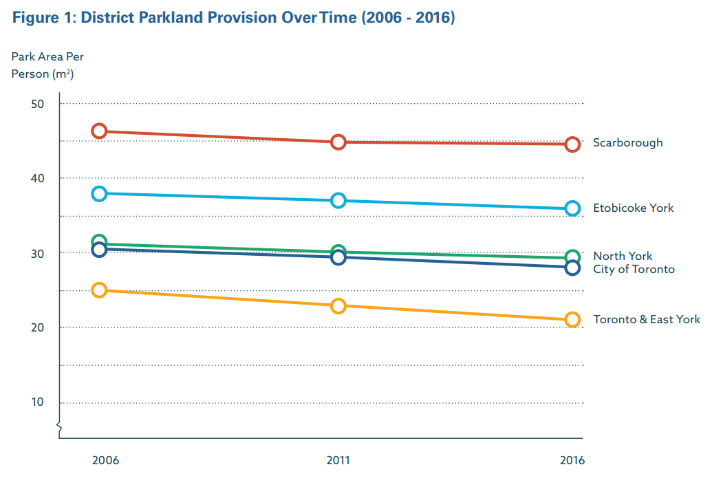
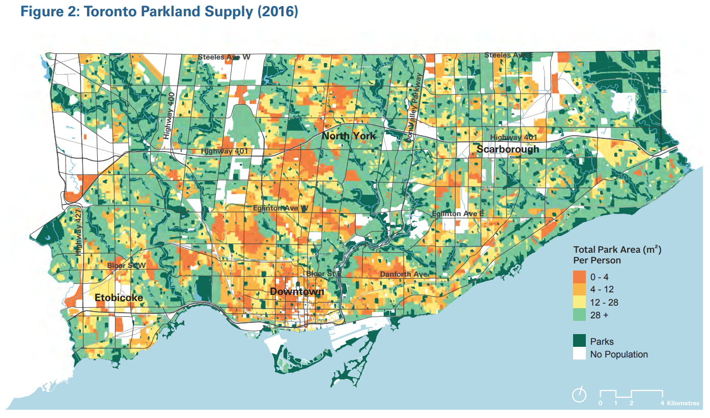
The other driver for this is the continued inequality of how parkland is distributed throughout the city. In addition to general inequality between the community council areas, there are particular neighbourhoods and districts with severe deficiencies, with almost no parkland within a walkable distance.
So the city is currently drafting the Parkland Strategy with this in mind, and sculpting it around four key themes:
- Expand: Creating and aquiring new parkland
- Connect: Bridging gaps between existing parks
- Improve: Reimagining the use of parks and open spaces
- Share: Programming parks and allowing multiple uses
I attended the #TOparks talk at City Hall held at the end of May, and was able to ask a question. But I wanted to come back, recollect my thoughts, and provide structured comments on what the Parkland Strategy should look like. Below are my four key recommendations.
Parks as a Transportation System
The theme of connecting in the Parkland Strategy talks a lot about ensuring there is access. Definitely important; if you want to enjoy a park, you need to get to and from it, as well as around within it. And to be clear, we’re talking about access by foot, bike, or other active transport. But I can’t help but feel like this has a ceiling to it. We need to elevate this from accessing parks for parks sake, and realize that parks can be a transportation system; A and B may be outside of a park, but you want to get between those points through the parks.
Screw the sidewalk. Walk, bike or whatever to/from work, home, a friends house, a community centre, or a restaurant in nature. Fresh oxygen > nitrous oxides. Birds singing > tires roaring.
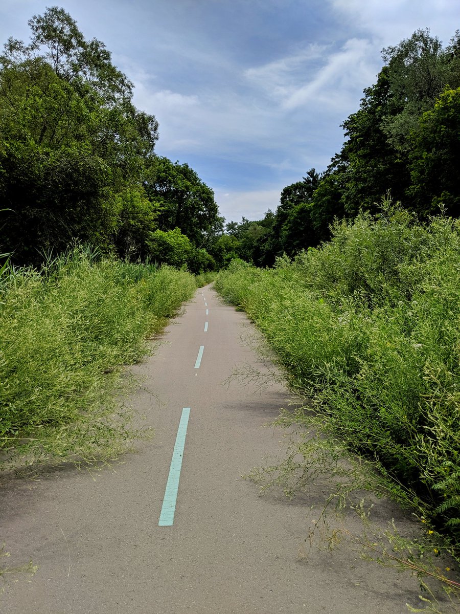
All parks, regardless of their intended primary function (nature preservation, recreation, cultural hub, utility conveyance) need to have active transportation as a foundational component, mandatory and integrated. Not as an afterthought, not as a low-priority accommodation around other features.
It needs to be set as priority one, providing the shortest desired path for where people need to go. It needs to be done in a high-quality fashion too. Wide enough to accommodate all users, and in a way that is convenient, safe, assigning priority and reducing conflicts. This means building bridges, underpasses, other appropriate crossings, and reducing grades, much like I highlighted in my piece about The Meadoway.
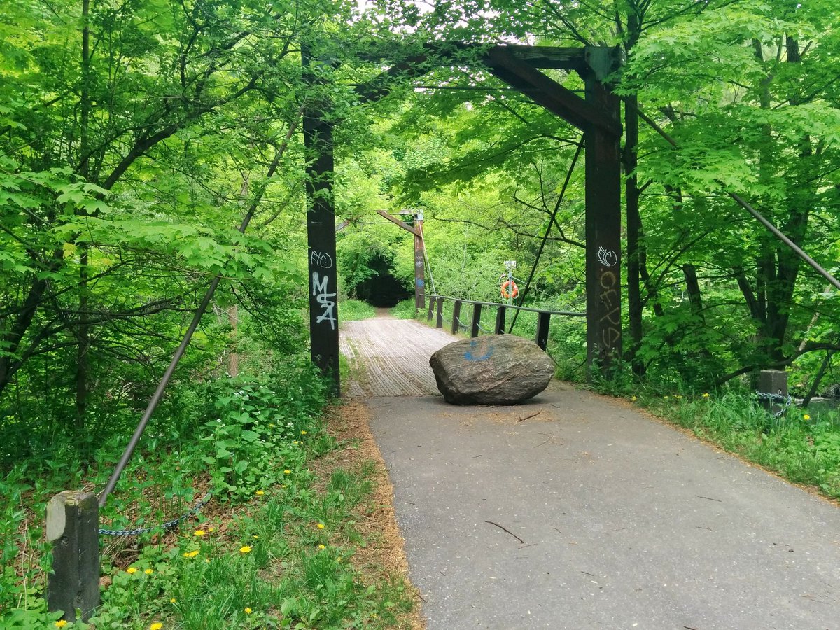
I’m not just talking about new parks, or parks in the process of enhancement either. There are a whole slew of parks and open spaces that already exist, but do not allow for active transportation access. I would know, after all of my travels. There’s lots of low-hanging fruit, such as utility corridors (besides the Meadoway) without formal trails, corridors without bridges across small streams or railways, and spaces that are simply overgrown and need some mowing and/or tree trimming. While hard and complex infrastructure may take a few years to plan, design, fund and build, there are lots of cheap quick wins that can be implemented within a year or two max.


The city’s parks and transportation departments need to work together to recognize that the active transportation network is an essential city service, and for more than recreation. This means park plans need to be meshed with other transportation plans, and work together when links in the active transportation network can be achieved.
Parks as a Stormwater Management System
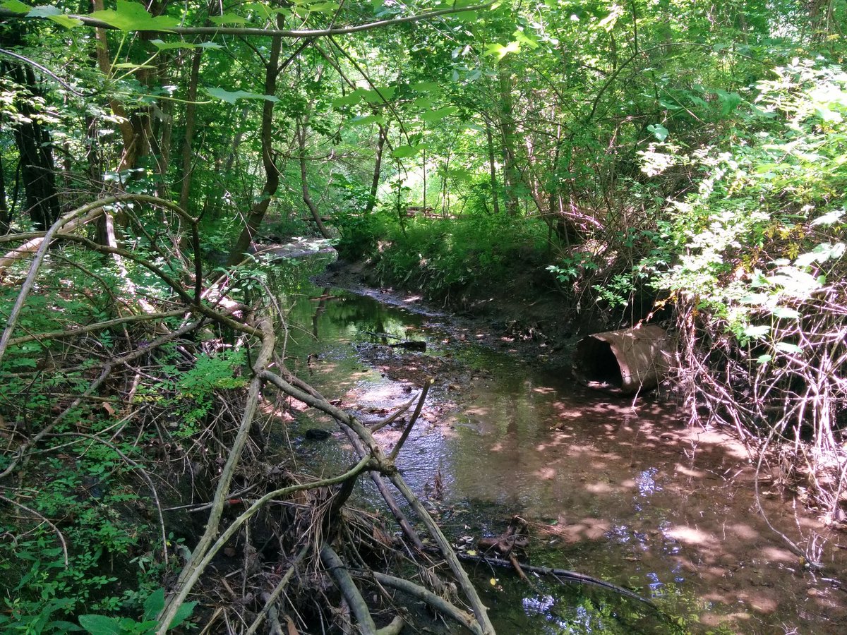
Much of our park system is built off of the ravines, and the various tributaries of our 6 main rivers. It’s obvious by looking at a map of the city’s parks, and seeing the corridors that generally align northwest to southeast.

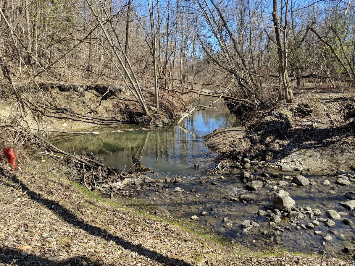
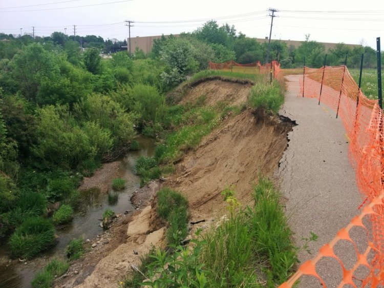
However, some existing parks with open watercourses are at risk, and it is playing out in ravines across the city right now. Our built city has lots of paved surfaces, which means when it rains, there’s lots of water runoff that suddenly needs to go somewhere instead of soaking into the ground where it fell. Many paved surfaces direct this runoff into a drain, which connects to a sewer, which outlets into a nearby creek or river. And that style of stormwater management creates an unnatural, sudden, fast rush in water during and after a storm.
We’ve gotten better with our modern development, creating more porous surfaces to control the water on site, or at least direct it into some kind of management facility like a grassy ditch, a wetland, and/or an engineered pond. But it’s still not in place for many areas of the city developed after the war, when managing stormwater wasn’t mandatory. The impact: streambanks that erode and take trees, trails and anything else in the way with it, in addition to poor water quality.
If we want to protect our existing parkland, we can do so while creating new parkland at the same time. New stormwater management facilities often require a chunk of land (again, examples being ponds and wetlands), so making it parkland while we’re at it only makes sense, especially if it connects directly into the ravine we’re trying to protect and enhance. Problem, meet opportunity.
On a related thread, there has been a lot of awareness in Toronto about our lost rivers, natural ravines and tributaries that were buried and placed into sewers due to pollution, or to allow development. There has also been talk about potentially daylighting these creeks in the parkland and open space where they still exist, and restoring ravines where they do not. Taking these measures is, just like the engineered stormwater management mentioned above, a great way to enhance our existing parkland, expand our park system, and create corridor connections over time.

The thing with restoring a lost river is that it would be a long and complicated task. This leads me to my next point.
Parks as a Well Planned System
Lots of new or revitalized parks are isolated leaps at solving problems and capitalizing on random opportunities when they present themselves. Rail Deck Park emerged out of dire parkland needs downtown and the existence of the Union Station Railway Corridor. Downsview Park resulted from the decommissioning of a Canadian Forces Base. The Leslie Street Spit became Tommy Thompson Park after it was no longer needed as a ship harbour.
There are other examples, but the main point here is there is no particular method. Someone brings an idea to the table, and if it is popular, convenient, meets objectives, and we have enough money, we go for it. It hardly seems like they are stitched together by a broader purpose. We just take what we can get.
The one notable exception, of course, being the waterfront revitalization led by Waterfront Toronto. That is driven a long-term vision to open the waterfront back up for public enjoyment, and create new development opportunity. It’s a broader vision and purpose that is earmarked for a specific area.
Looking at other systems, we have examples of transportation systems guided by long-term plans. Metrolinx has its regional transportation plan that sets out specific rapid transit projects to be undertaken in the next 25 years. The city has a 10 year cycling plan to add cycling infrastructure to certain streets and parklands, bridging gaps in a broader grid and meeting cycling demands.
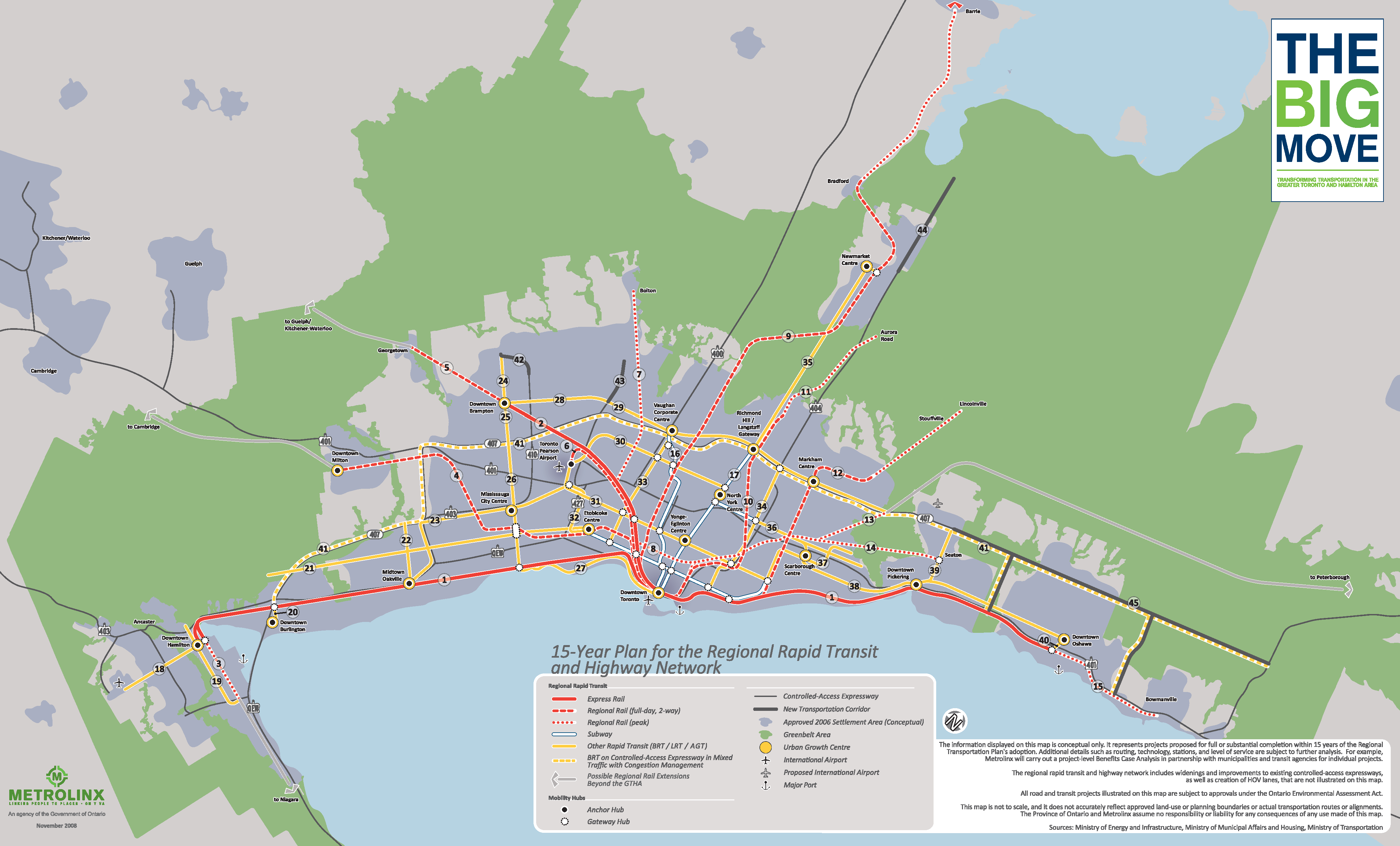
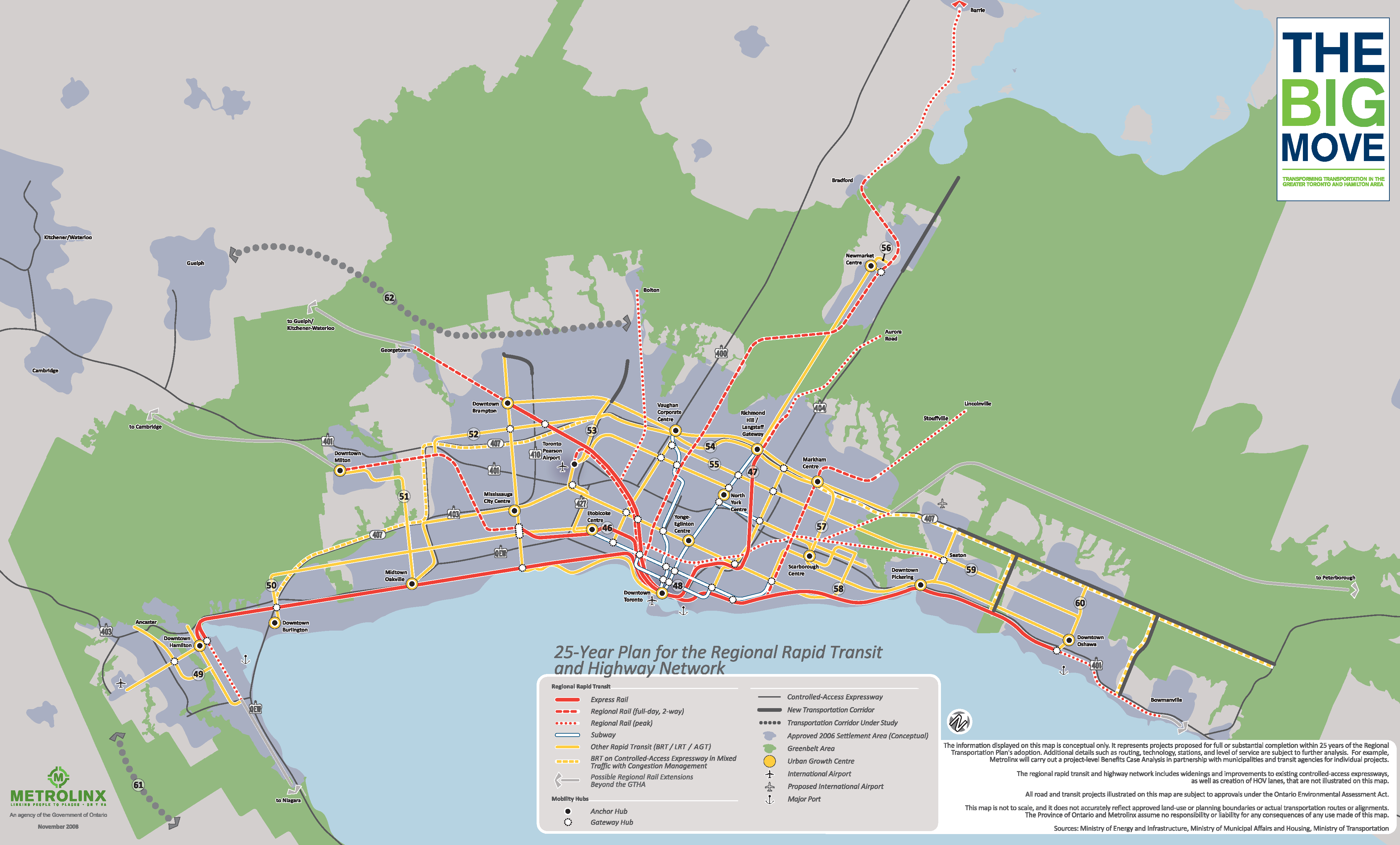
The Parkland Strategy is supposed to be a 20 year plan. The vision, objectives, priorities, and principles that are being discussed to date sound like a great core to the document. But I feel that without specific schedules or operating plans, it will continue to only be a vision document with no path to get there, and we will keep acquiring parkland in a random, fractured, opportunistic manner.
The Parkland Strategy needs to be complemented by specific capital/operating plans. I am generally proposing two, one short-term and one long-term, but different numbers, purposes and timelines will work:
5-year Plan
- A Capital and Operations Plan for projects to be led by the city in the short- and medium-term, or by other governments where agreements are already struck.
- Improvements or changes to existing parks
- Acquisition, guidance and negotiation through development planning, and planning of other city capital works.
- Considers funds required in both capitals and operating budgets
- Considers policy changes that need to be made
- New plans every 5 years; 4 plans within the 20-year lifetime of the strategy
20-year Plan
- A broad stroke document that highlight the areas where connections, expansions or improvements to the park system should occur
- Zoning changes, and areas to be redeveloped
- Major, multi-year capital projects with interactions with multiple stakeholders
- A road map for complex projects requiring significant planning and design work
- A concrete plan to acquire smaller pieces for assembly over the long-term
- Updated with changes during 5-year plan drafting, reviewed every 20 years
This approach will ensure that all governments and stakeholders have common, concrete lists and maps of projects to guide their actions, and that the public has a clear document to information and accountability. It eliminates the risk of the strategy’s generalized vision being interpreted in different ways, and executed in a haphazard, opportunistic way. The park system can be expanded, improved and connected over the long-term.
This is particularly relevant for components that need years or decades to be built, small pieces at a time. Daylighting and restoration of ravines is a good example of this; the only way we can achieve this is to assemble pieces of land acquired over the long-term, slowly unwinding the urban fabric built around them. We need a well-defined document to guide us.
Parks as a Well Governed System
The thing with effective park system planning is that there are various parks and open spaces, involving multiple stakeholders with differing ownership, rights, roles and responsibilities. Some of these are laid out in the table below:
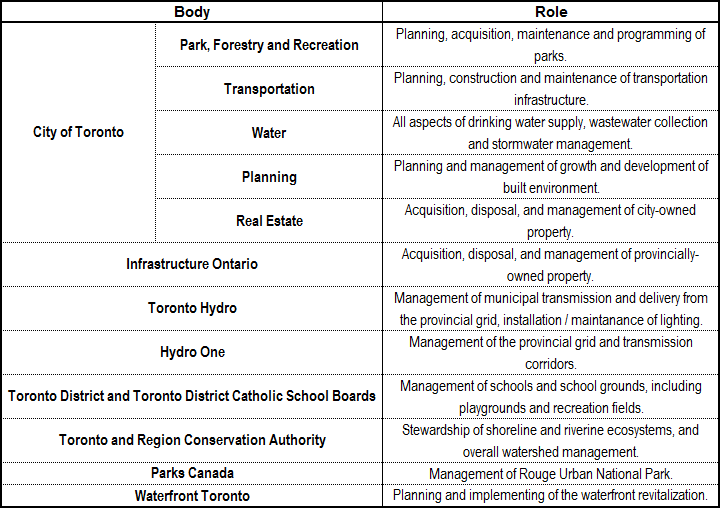
Administration of the parks system needs to be a broader, multi-governmental agency to ensure all players are brought to the table, silos are broken, and parks are created / improved / enhanced in a multi-disciplinary and effective manner. This is what makes Waterfront Toronto extremely effective: it is an agency representing all three levels of government, and is the primary authority for coordinating the waterfront revitalization. If we truly want a cohesive, well planned and well managed parks system, we need to consider bringing a similar governance structure for the city’s park system.
The added benefit to this is money. Having adequate money for a park project can be a difficult thing, as Rail Deck Park has shown us. We have to rely heavily on money from growth and new development (section 37 funds, development charges, developer contributions) which can contribute to the park space inequality mentioned up front, and when it isn’t enough, convincing politicians to allocate additional money is a hard sell.
By bringing other agencies on board with the park planning process, parkland can receive funding through other budget brackets and funds. Funding earmarked for new or improved water / wastewater / stormwater systems, active transportation paths, electrical transmission equipment, watershed management and/or nature conservation can all be leveraged to bring down the total bill of creating / improving parks, if that work is integrated into parkland. It also garners more political support if it checks multiple boxes.
The first common theme to all of this is creating a Parkland Strategy that is multi-disciplinary exercise. A park system is more than vegetated open space to unwind and play in. There are critical services that occur in them, to manage stormwater, to transport people, to deliver power, and act as social community spaces. Expanding and improving our parks sounds like an uphill task, but I’m convinced that more effort needs to go towards better integration of these other components that are normally seen as secondary.
It’s second common theme here is a long-term, continual improvement. A great park system will not be built in a day, let alone the lifespan of this 20 year strategy. Everybody has to work together towards the same goals, and not diverge due to interpretation. And those goals have to be consistent over time.
If the Parkland Strategy is going to be successful, it must be a team effort with a single vision. If we get that right, we can achieve a great park system for Toronto.

Great write up!
LikeLike