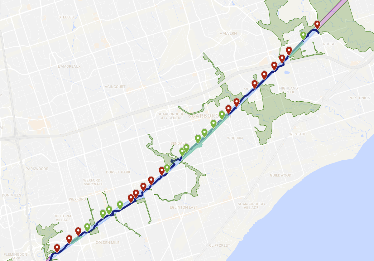
Expanding on a Twitter thread I wrote back in April 2018, I took a look at The Meadoway, a project by the Toronto and Region Conservation Authority, in partnership with the City of Toronto and The W. Garfield Weston Foundation. The project is a reimagination of the 16 kilometre Gatineau Hydro Corridor, which is a provincial hydro line between the Bermondsey substation in Thorncliffe Park northeast to the city border in Rouge Park. As the name suggests, the corridor would be converted from the manicured grass that exists in many sections into a meadow habitat, and would also include a multi-use path to support cycling and walking.
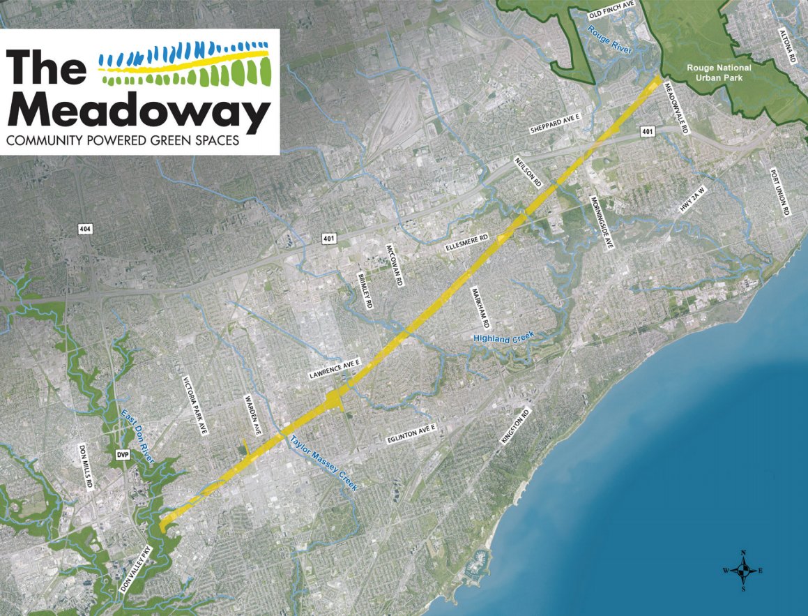
I took a look at the proposal and did some exploring of The Meadoway myself. Below is an interactive map you can use to follow along through this analysis.
Build Bridges, Not Barriers
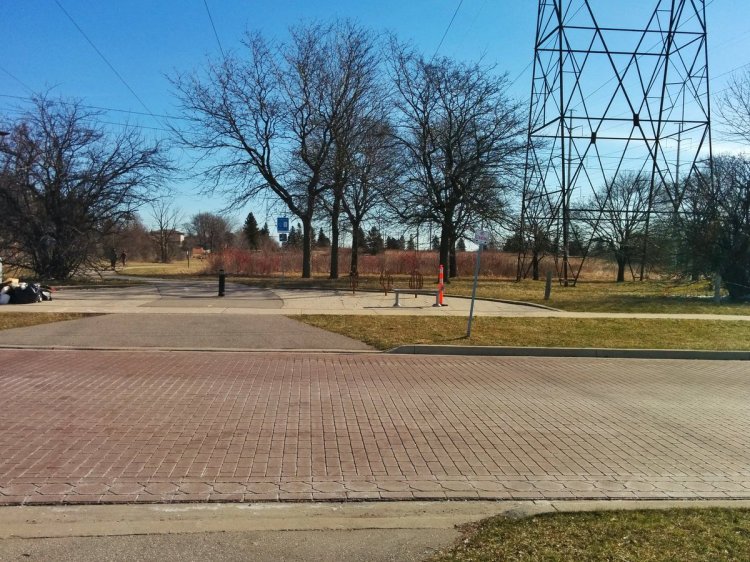
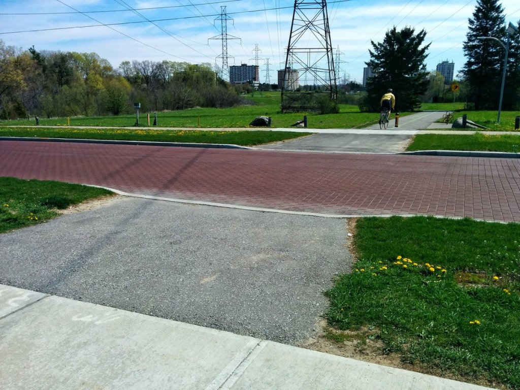
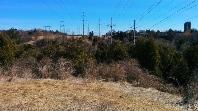
Naturally, with all the walking I do, I have quite a few thoughts about road, rail and ravine crossings; the 3 Rs. I’ve walked my fair share of uility corridors (Sept. 2016, Feb. 2017, Feb. 5 and 10, 2018), and have experienced first hand what works, what doesn’t, and what sucks when you got nothing at all.
R number one is roads. All road crossings on the existing trail segments are at-grade, and generally take one of two forms: an unprotected crosswalk (but sometimes with raised and/or textured pavement), or a traffic light. The former is used primarily on smaller, two-lane local roads with little traffic, and the latter is used for all other locations where traffic is heavier. Either a dedicated mid-block traffic light is set up to allow pedestrians and cyclists to cross, or the trail is purposefully directed to an existing road intersection where traffic lights and crosswalks already exist.
In my opinion, unprotected crossings are sufficient on quiet, local, 2-lane roads with 30 km/h speed limits, as long as they are scaled appropriately; textured pavement and signs at a minimum, using raised bumps and pavement markings and giving right-of-way to pedestrians and cyclists as the road or trail traffic increases. When it comes to arterial roads, a high quality trail should stop using at-grade crossings, and give increasing priority to trail users.
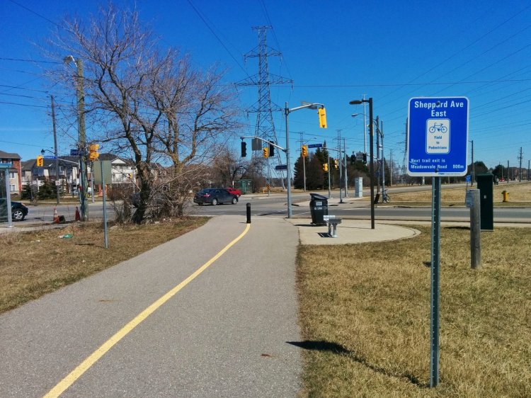
It’s hard to argue against using existing traffic signals and crosswalks where a utility corridor already meets an intersection. But from my experience, mid-block crossings that use traffic signals are problematic. All of these traffic signals are not programmed to be responsive to and give priority to trail users during the day; instead, they are programmed to sync with an existing time plan that controls other traffic signals and vehicular traffic flow in the area. This means a trail users could push a “beg button” and wait a couple minutes for the signal to change. This does not give any priority to trail users, and it creates risks of trail users jaywalking into traffic, or vehicles ignoring the signal. It begs the question: what kind of city are we designing that we are making trail users “beg” to cross at all?

I would argue Toronto’s famous yellow crosswalks would be more appropriate for some crossings where traffic isn’t too heavy along the trail or the road, and vehicular speed limits are lower, as it safely gives on-demand priority to trail users, and allows vehicles to proceed as soon as the trail user has finished crossing. It strikes a balance. However, as soon as traffic or speed limits increase, I’d argue that grade separated crossings should be required. The city is generally anemic to this, however; they are much more expensive due to potential utility conflicts and accessibility requirements, are disruptive during construction overall, and require an unreasonably high bar of risk.
If we’re going to create a high quality multi-use trails in the Meadoway, and frankly anywhere else in the city, we have to stop cheaping out on our infrastructure like this, and start putting greater value on trail users’ time, experience, and safety. But with a total budget of $85 million (for everything; naturalization and infrastructure), I’m not entirely confident that it is enough to cover the 8 arterial road crossings (Eglinton, Victoria Park, Kennedy, Midland, Scarborough Golf Club, Ellesmere, Neilson, Morningside) that currently have no infrastructure. And it sure doesn’t address the 4 existing mid-block crossings on arterial roads (Markham, Bellamy, Warden, Pharmacy) that currently use traffic signals.
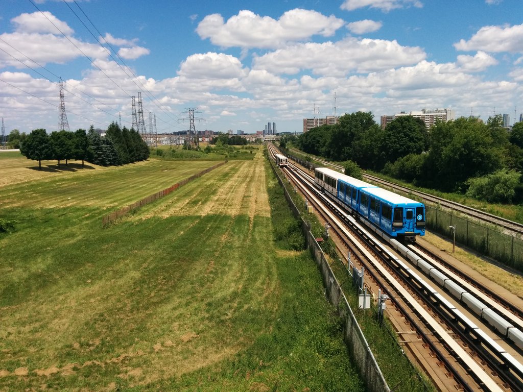
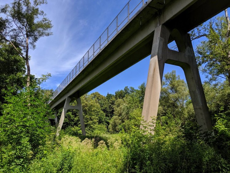
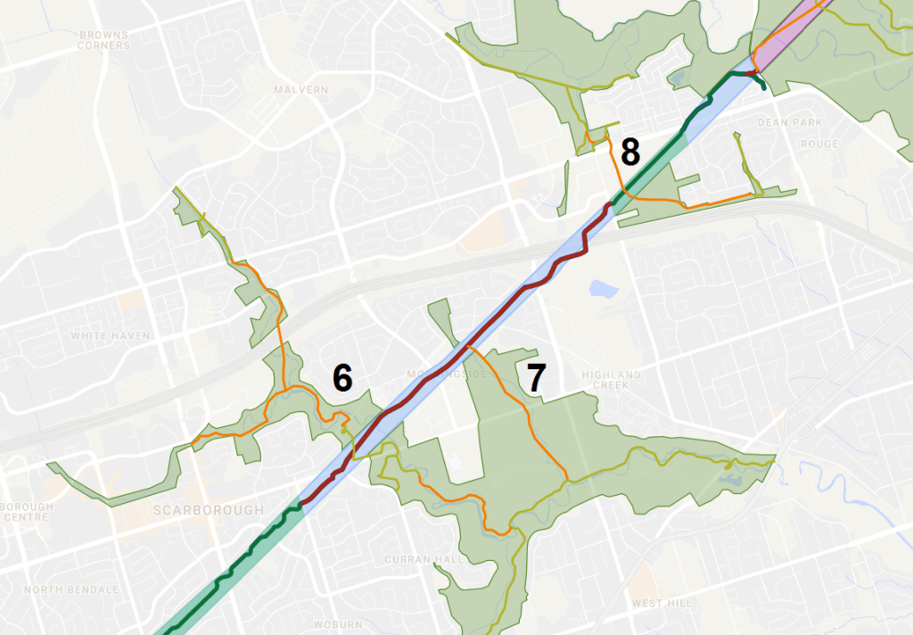
That’s roads. The second of the 3 Rs of trail crossings is railways, and the only rail crossing along the Meadoway is the corridor with the TTC’s Line 3 and GO Transit’s Stouffville Line. As it stands now, getting across the corridor (between Kennedy and Midland) requires a trail user to detour south through Jack Goodlad Park, and use an existing pedestrian bridge between Mooregate and Tara Avenues. This doubles the required travelling distance (900 to 1,800 metres) and takes trail users away from the meadow, requiring a meander through an adjacent neighbourhood. It might be attractive to use this existing infrastructure and save more money, but this bridge is fairly skinny and does not deliver a good user experience. Once again, if the Meadoway’s goals are to deliver an attractive alternative transportation corridor that stays with the natural environment, a new crossing is required.
The third of the 3 Rs of trails crossings is ravines. One of the Meadoway goals is creating east-west linkages between the ravines of Scarborough. This will involve crossing 3 major ravines: East Highland Creek, one of its tributaries, and West Highland Creek. The latter is already completed, and is done quite well in my opinion, interconnecting with the other existing north-south trails. However, the other two are quite steep and have considerable erosion issues.
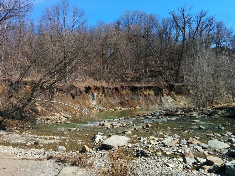
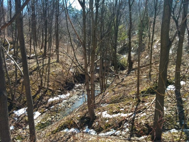

A multi-use path winding down a slope makes sense if you’re trying to get to a connecting north-south trail within a ravine, if/when they exist, so this is definitely a benefit of taking that as a main approach. The drawback is increased distance, stemming from the fact that as ravine slopes increase in grade, you usually need longer switchbacks to accommodate users, particularly those living with a disability. It’s absolutely necessary, it just lengthens the distance if you’re just following the Meadoway. But including a bridge structure is an opportunity to reducing that distance for those going through, and also to provide an opportunity for stunning views. This should be considered for the three major ravines the Meadoway will go through.
Over the Line
As with any project, you have to set a scope. While I completely understand the reason for doing this, I’m kind of left wishing that we could go beyond the scope in two specific instances. One has to do with missing links in the broader trail system that the Meadoway should connect to. The other is the east and west limits applied to the Gatineau Hydro Corridor itself.
The Meadoway aims to be an east-west link between north-south oriented ravines and parklands that have trails. But some ravines and other parklands do not have these connections. These are illustrated and listed below:

- In the west, the East Don Trail is currently non-existent between Concorde Place and the Forks of the Don. However, the city is currently planning its implementation and connection to the Meadoway, and construction is set to begin this year.
- A north-south utility corridor between Ashtonbee Reservoir Park and the north end of the city is mostly accessible to the public, but does not have a formal trail or well-defined footpath to follow.
- A footpath exists adjacent to Massey Creek, but it is not formal, and does not exist south of Bertrand Avenue.
- A formal trail exists along the Scarborough RT corridor between Kennedy Station and the bridge mentioned above, adjacent to John Goodlad Park. There is no connection north into the bounds of the Meadoway corridor, or to Lawrence Avenue.
- There is a trail network along the Dorset Branch of West Highland Creek up until Brimley Road, and then there is not trail further west to its intersection with the Meadoway.
- A collection of footpaths exist around the East Highland Creek area, but there are no formal connections south to the Highland Forks, or north to Centennial College and other parklands.
- There are no paths along Ellesmere Ravine, and similar to the ravine to the west, no formal connections south to the Highland Forks.
- The Meadoway is pretty much established east of Conlins Road, but not paths exist in the adjacent assorted parklands.
Building these connections is critical to linking more neighbourhoods to the Meadoway, and it meshes with the goal of allowing greater travel without leaving the natural environment.
The other scope limitation is along the hydro corridor itself. While the Meadoway’s scope ends at the East Don River and Meadowvale Road, the hydro corridor continues beyond these bounds, and not including these end pieces creates some missing links too.


In the west, the Gatineau Hydro Corridor continues to Thorncliffe Park, where the transmission lines connects to Hydro One’s Leaside Transformer Station at 1080 Millwood Road. Extending the Meadoway west would create a great opportunity to better connect the neighbourhoods of Leaside, Thorncliffe Park, Flemingdon Park, and Bermondsey, which are currently fractured by the Don Valleys and the Parkway. In the east, the Gatineau Hydro Corridor continues into Rouge National Urban Park. Extending the Meadoway east to the city border could provide a critical connection to the park, over the Rouge River to two existing north-south trails, and the future Beare Road Park.
A First Phase
The Meadoway’s vision is amazing, and it will be an incredible improvement to a considerable stretch of Toronto. I have my criticisms, but these aren’t really directed at the project’s lead, the Toronto and Region Conservation Authority. It’s more so towards their partner, the City of Toronto. This will be a natural corridor that links ravines, so that part of the project is covered. What needs improvement is the hard infrastructure: the trail, it’s crossings, and its connections. That should be the city’s responsibility, financially, and from the standpoint of creating recreational opportunities and building a transportation network.
If anything, the Meadoway project’s current scope should be considered a first phase. The second phase should be led by the city, with the goal of considerably improving the trail within the corridor, as well as connecting the broader trail network and the city as a whole.

