About a year ago, I reviewed a draft version of the Toronto and Region Conservation Authority’s (TRCA) Trail Strategy for the Greater Toronto Region (Trail Strategy). I focused on the parts of it within the City of Toronto, and suggested:
- Four significant corridor changes;
- Three alternative connections;
- Five map corrections; and,
- Three remaining gaps.
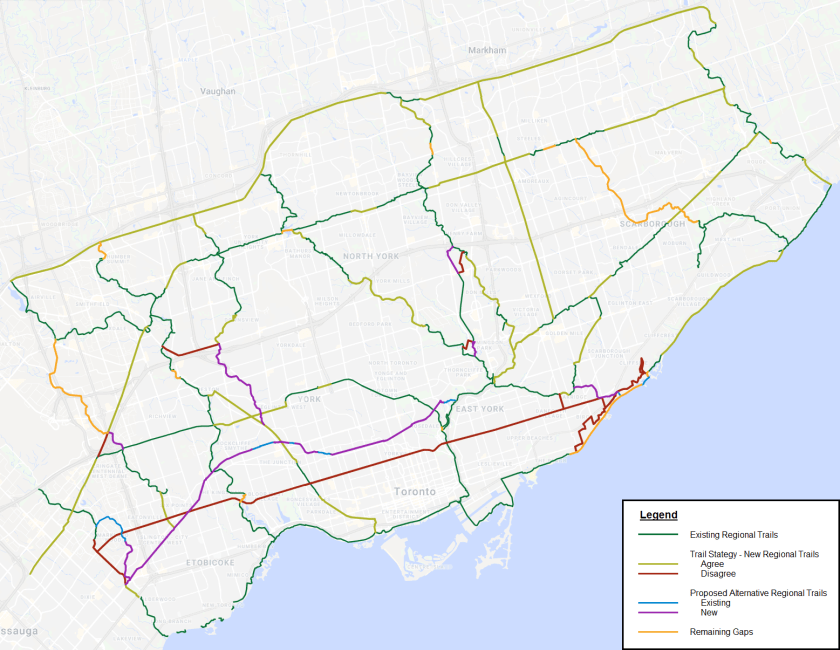
The TRCA published a final Trail Strategy, which was endorsed by their board on September 27, 2019. I’m happy to report that:
- My suggestion for Scarborough Waterfront West has been adopted;
- The future Leaside South connection has been illustrated;
- The Weston North Humber Connection gap was recognized; and,
- The Finch Hydro Corridor trail will be kept within the corridor across the Metrolinx Uxbridge Subdivision.
It definitely feels good that I was able to lean on my walking experience and create some change in a major planning document. This will help create continuous trails along the waterfront, Humber River and Finch Hydro Corridors. Furthermore, some of the things I raised were (relatively) small scale details that I’m not too worked about.
That said, I am a bit disappointed that three of my large scale suggestions were not taken up.
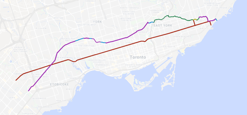

- The Crosstown Southwest corridor is the biggest disappointment for me, and is somewhat baffling. It is a natural corridor that would be richer than the bike lanes on Bloor. Furthermore, the middle part between Davenport and St Clair is a formally recognized project by the city, and there is about a kilometre and a half of existing trail west of that. I thought filling in the gap in the Stockyards area and continuing the line past Rockcliffe Boulevard to Etobicoke Creek was a good idea.
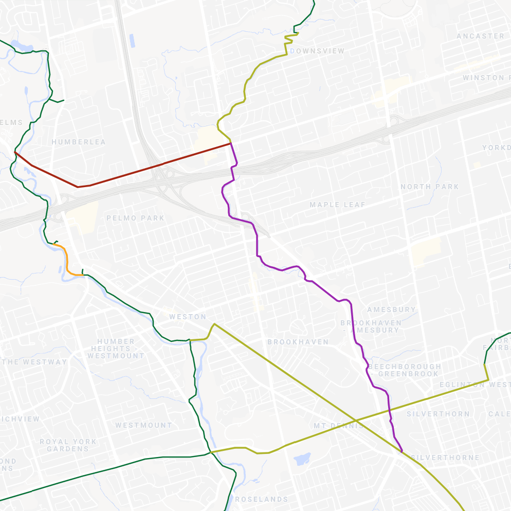
- A trail through Black Creek Ravine also seems like a relatively feasible project, as pretty much all of the approximately 6 kilometre trail would be on existing, publicly owned parkland and open space. The only exception would be a half-kilometre stretch under the Highway 400 / Jane Street interchange, which is still public land, making access negotiable.
- North Scarborough has this ginournous gap in north-south connectivity. Once again, there are existing segments of trail and most of the ravine is intact. It may be constrained in spots where wetlands are present and a meander belt is protected for, but I think a link to Scarborough Centre should be worth the effort.
Progress is slow and steady sometimes, and the fate of these potential trails is not sealed. So I will take this as a win, and I hope Torontonians will continue pushing for a better trail network.

One thought on “Public Review Update: Toronto’s Regional Trail Strategy”