2020 was garbage. Most annual reflections will have that message. It caused me stress in my professional and personal life, but looking back, I didn’t do too bad in terms of exploring the local metroscapes.
This was my first full calendar year living in the Tri-Cities, and adjusting to the shift. It was my opportunity to explore new places and get familiar with my new home base. But it was also a time to reflect and build upon the change it had brought about to my website. This was no longer a Toronto-centric hobby. This was exploring the intersections between natural and built environments in multiple cities.
Thanks to COVID-19, I didn’t get to explore The Hammer or tie up loose ends in Toronto as much as I had hoped. The first and second waves kept me close to home, avoiding non-essential trips on public transit and at other indoor settings in other cities. But I had a couple of worthy trips, and lots of analysis to go with.
So let’s do another year-in-review, review the ground I was able to cover in this pandemic year, and look forward to what 2021 will bring.
New Projects and Posts
Let’s start off with the new projects I launched this year. There were a few that came with settling into the Tri-Cities’, and launching into a third city.

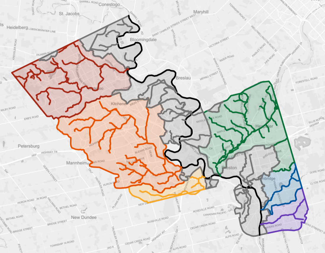
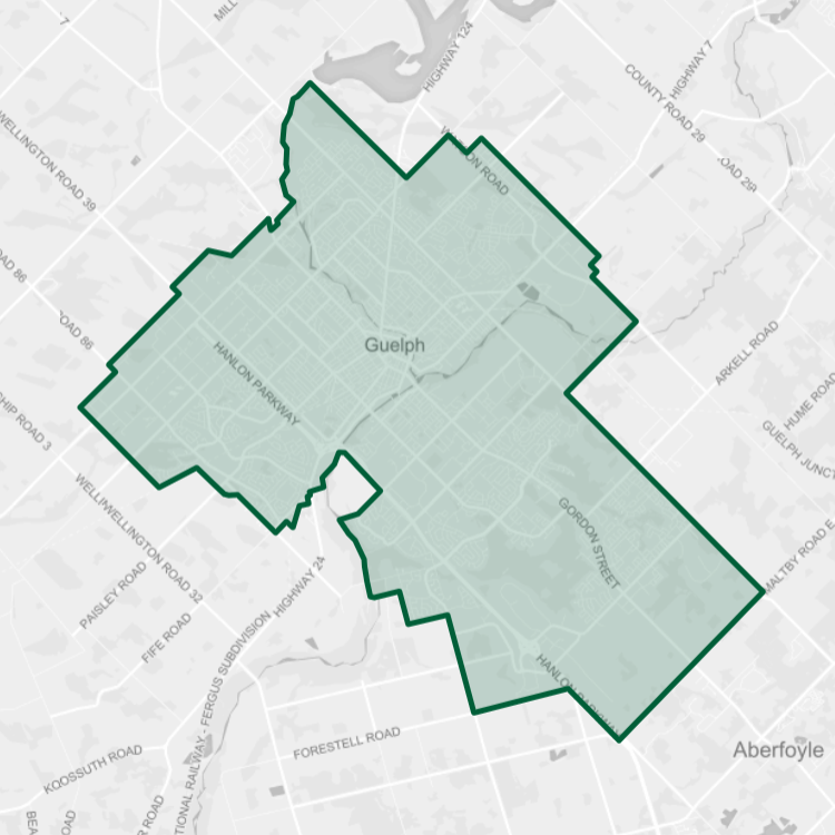
After four months in the Tri-Cities, I was able to get my head around the urban fabric. I was able to nail down the layout of its neighbourhoods, and delineate the way of the watersheds. Unlike Toronto, the Tri-Cities still has greenfield areas, and drains to a large river instead of a shoreline, so having a better grasp on the lay of the land was helpful.
Then COVID-19 happened. As we began getting our heads around how it spread and the precautions we had to take, it really highlighted the importance of public space. This spoke to my philosophy on the freedom to roam along waterways, shorelines and utility corridors in our urban centres, and how we should be doing more to connect the missing links.
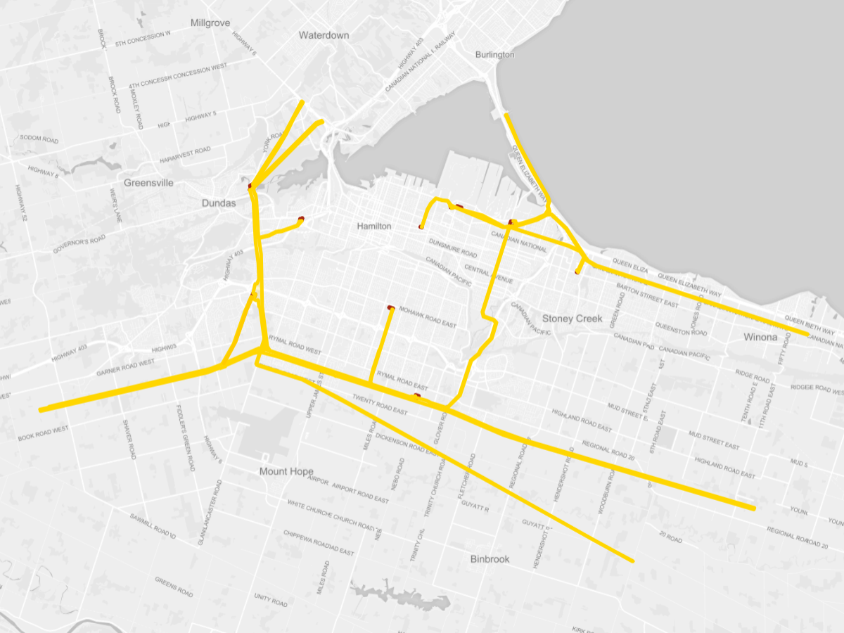

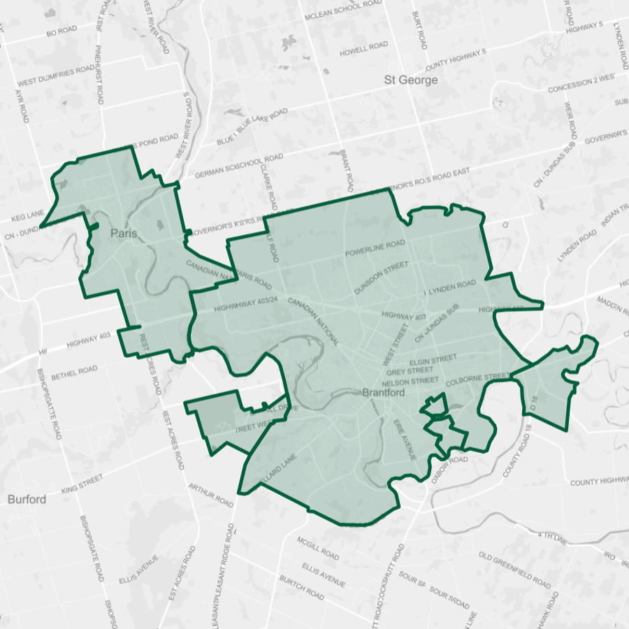
I then expanded to Hamilton in the summer. I discovered quickly that I needed to scope my area of analysis to account for its amalgamation. I was then able to complete project analysis for its shoreline and hydro corridors.
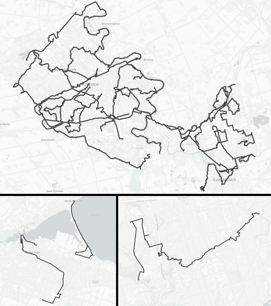
Lastly, I capped off a project I had been picking away at for two years: Crossing the Line, an analysis of Toronto’s freeways and railways. After experiencing these barriers first hand over 7 years and 1,400 kilometres, it’s nice to finally quantify it. I hope this will be a great resource for years to come.
Walk Statistics
I pretty much matched my activity from last year. Moving cities was something that held me back in 2019, so that’s why COVID didn’t cause me to do less in 2020.
- Over 27 walks, I covered 414 km, about the driving distance between Niagara Falls and Kingston. That’s 1 more walk and only 7 km more than 2019.
- The average walk was 15.4 km, virtually the same as 2018. This is the same distance as walking between Conestoga Mall and Mill Stations in KW.
- The longest walk was October 12, coming in at 24.8 km. This was following the Grand River from Highway 7 to the literal northeast corner of the city.
Walk Highlights
Normally, this is where I highlight the neighbourhoods and watersheds I covered and compare back to the previous year. But this is becoming less relevant as I shift towards multiple cities. Instead, I will highlight some of my notable walks.
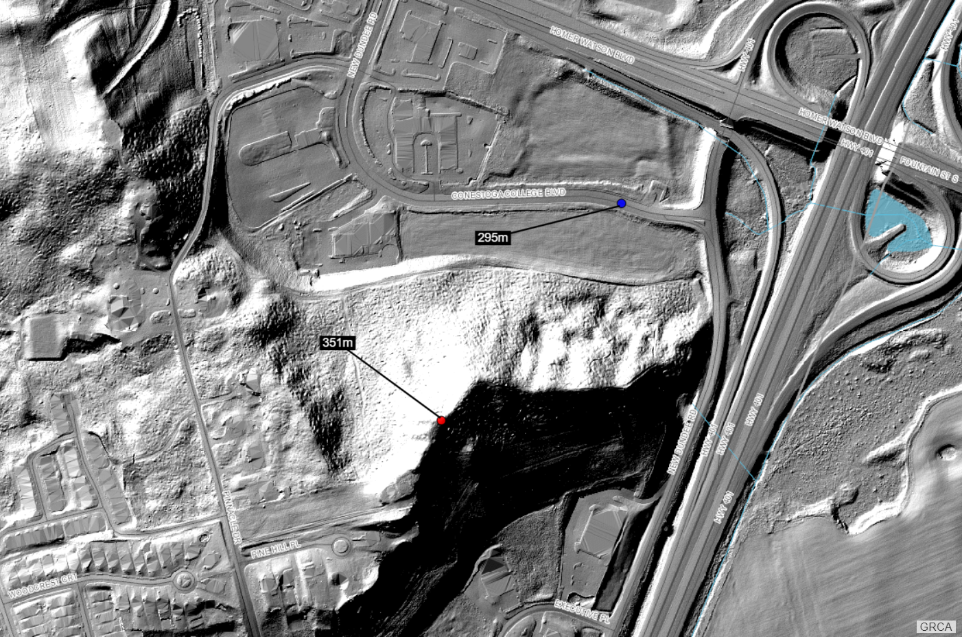

One big personal achievement was climbing Pinnacle Hill. It’s a pretty uninteresting drumlin at the 401 and Homer Watson, but it is prominent enough, rising 50 metres from Conestoga College Boulevard. I had noticed it every time my dad was driving us towards Toronto, and I always wanted to check it out, so it was fulfilling a tiny childhood dream.
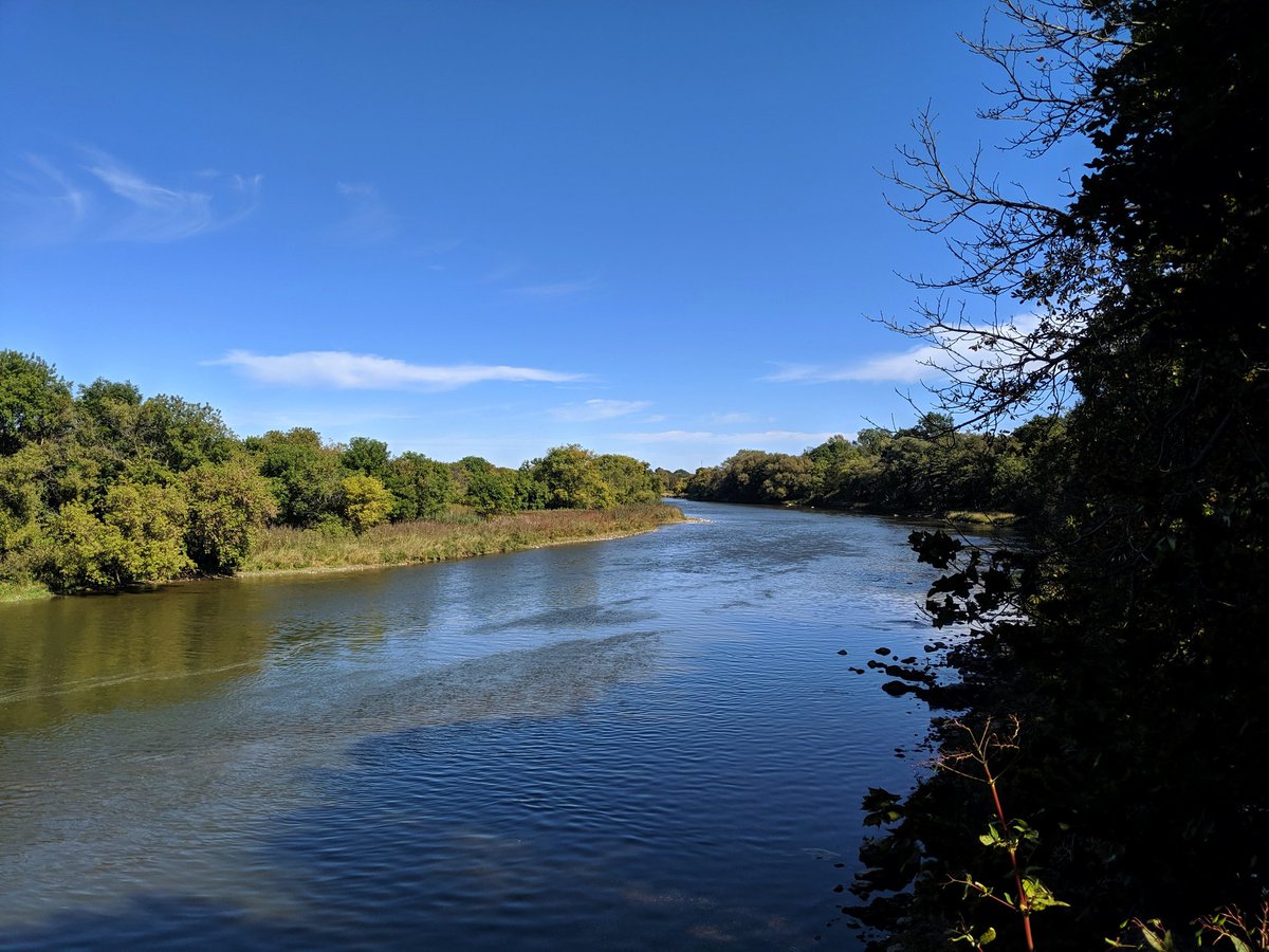
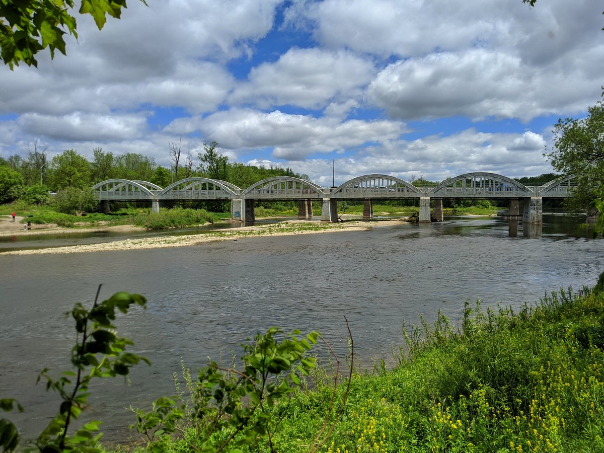

I also finished walking the entirety of the Grand River. I finished the first leg through Cambridge in October 2019. In 2020, I did the next leg to Highway 7 in Kitchener, and then the last stretch from there to the northeast corner of Waterloo. This makes for a total of 60km of walking along the trunk of the watershed.


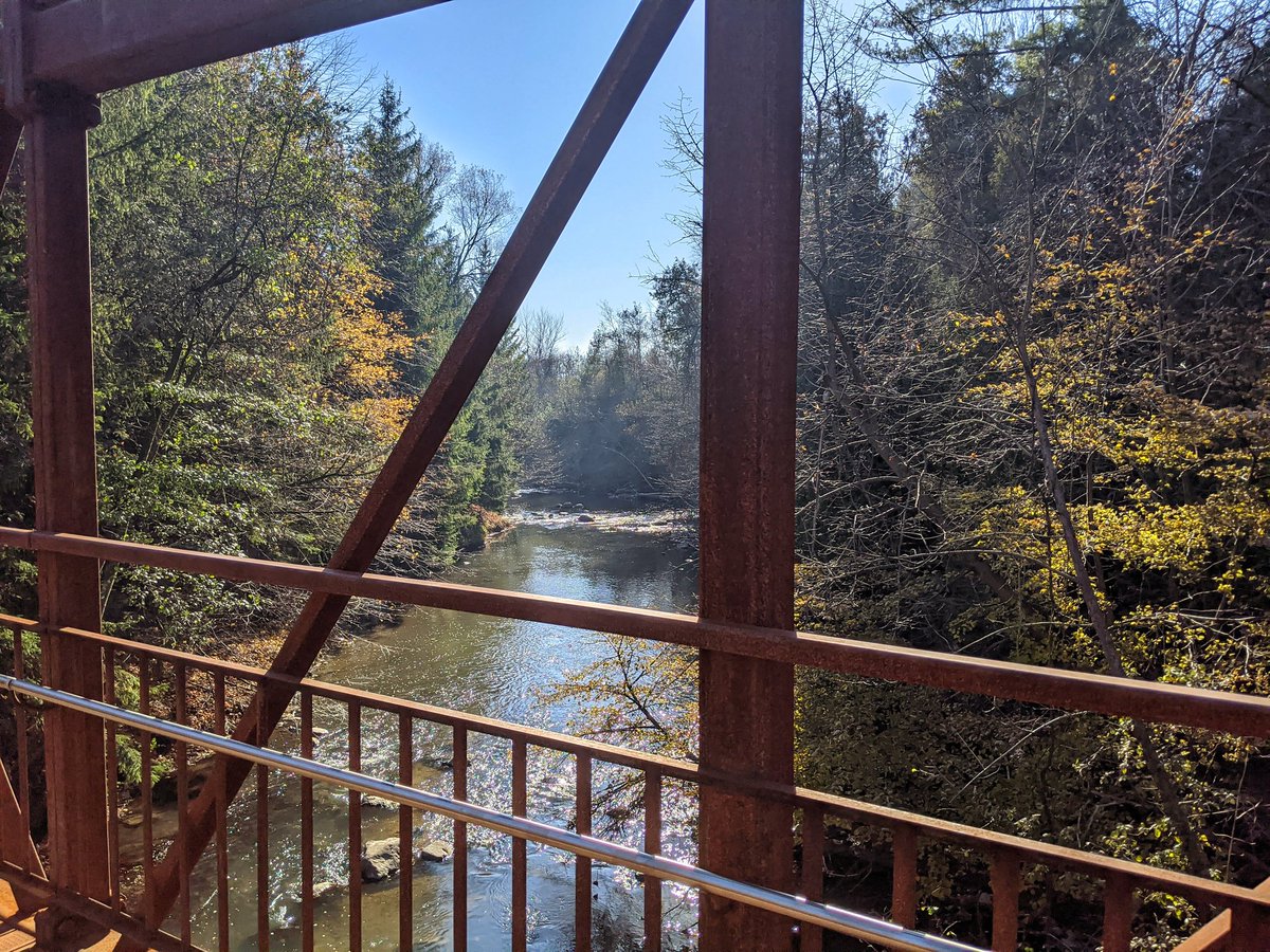
When I expanded into Hamilton, I was able to tackle one of its signature trails, a former rail line that slinks down the Escarpment. I hadn’t had much luck coordinating walks with peak fall colours in previous years, but it worked out pretty well this time.
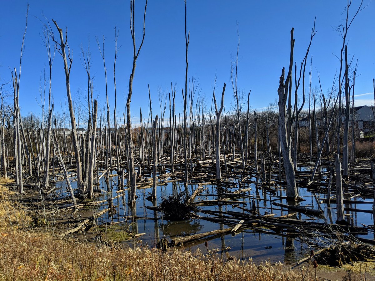
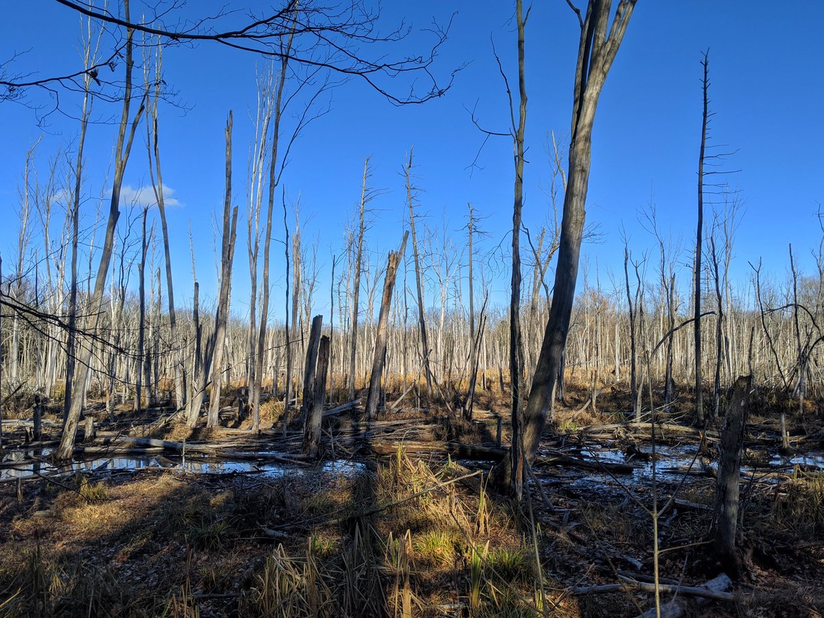
One of the first things I noticed after moving to Cambridge is the Portugese Swamp, a complex of wetlands bisected by Can-Amera Parkway on the east side. I was able to check them out first hand back in November, it was pretty neat.

Lastly, a big milestone was the first phase of the new East Don Trail. This was very significant to me not only because it was a major new multi-use trail in a ravine. The East Don Trail is near my old stomping grounds as a child, and was a place I’d go to often to ride my bike. So more childhood feels.
Looking to 2021
Moving to the Tri-Cities was a big shift, and adding Hamilton to the mix was another step in that direction. While I’ve reflected on the change a couple times, I’ve had some additional insight as of late.
It was a shock to realize I’m starting to run thin on plans for the Tri-Cities. After doing over 100 walks in Toronto, I did not expect to run into this problem so soon. Part of this is the area, as Toronto is twice the size of the Tri-Cities, and over 15% of the latter is still greenfields.
But it’s also history, density and growth. It makes for a different urban fabric. In older, denser and faster growing cities, utility corridors are well traversed albeit crowded on all sides, and a lack of stormwater management means more runoff that collects in numerous tributaries. This can make the public realm more granular and unique. By comparison, the Tri-Cities has plenty of wide open green spaces, generally larger and more intact. In between, the sweeping single-detached neighbourhoods with significantly more infiltration and stormwater management have less infrastructure and drainage corridors fracturing them.
It’s better from an ecological and flooding perspective. But it’s not the same for my walks.
I’ve been looking at expanding to other cities, all while coming to this realization. With this in mind, while I look to cities close to my home base, I will also be looking for the more fine-grained metroscapes.