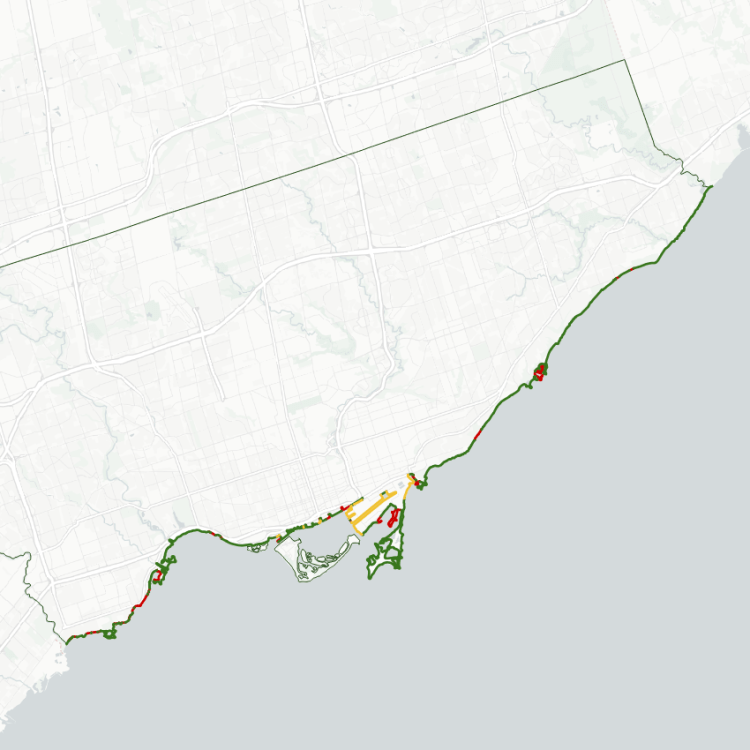
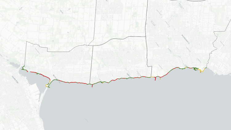
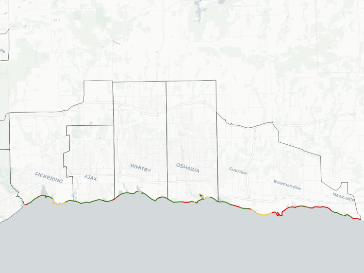
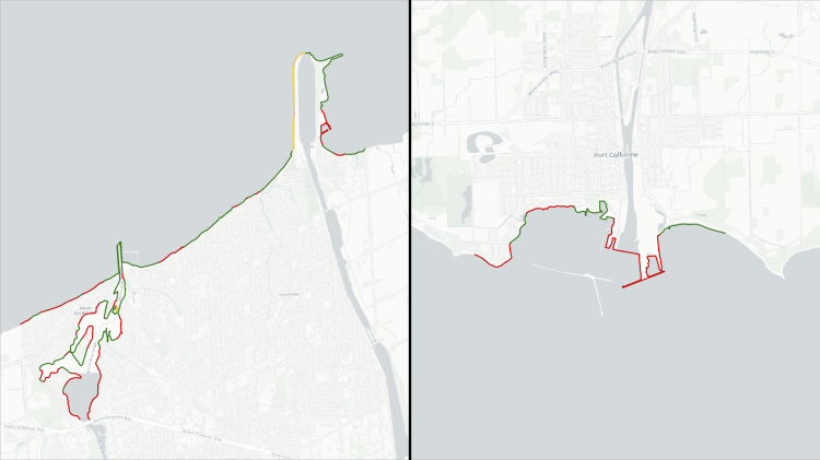
My interest in urban shorelines and its ownership started after taking a walk in Toronto’s southwest region of Etobicoke, and experiencing significantly fractured access. What followed was a metre-by-metre breakdown of the ownership, history, and use of Toronto’s shoreline, which I have expanded to other lakeshore cities, including Hamilton.
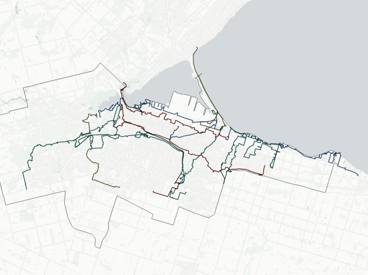
Hamilton’s shoreline stretches from Grindstone Creek in the west to the Fifty Creek in the east. As the crow flies, that’s 23 kilometres from border to border. But the total length of Hamilton’s shoreline is extended by peninsulas, inlets and a sand bar to over twice that length: 53 kilometres.
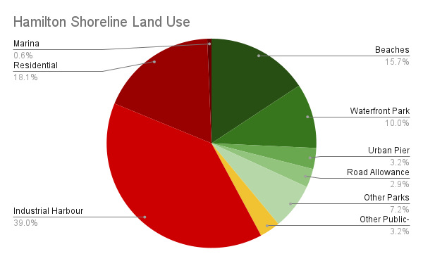
Overall, only 38% of Hamilton’s shoreline is publicly accessible. Less than 7% of it is provided in Stoney Creek. Furthermore, most of Stoney Creek’s public shoreline is highly fractured; excluding Fifty Point Conservation Area, the median piece of public shore is 39 metres long.
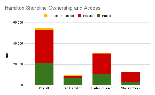
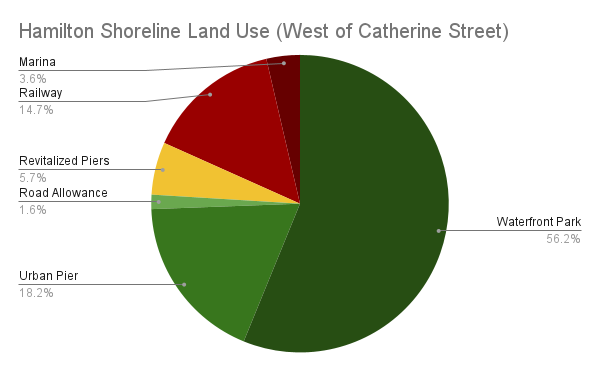
A good chunk of Hamilton’s public shoreline is part of the sandbar that carries the QEW Skyway to Burlington. A bit of an atypical landform, it accounts for nearly 20% of the total edge along Lake Ontario, and nearly half of what’s publicly accessible. A minor piece of that on the west side of the Skyway is fenced off, and Eastport Drive north of Pier 27 is hostile to public use. But overall, it represents a large asset to Hamilton and neighbouring cities.
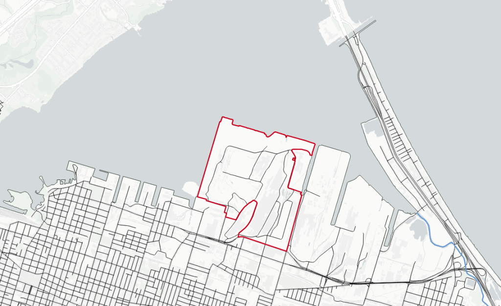
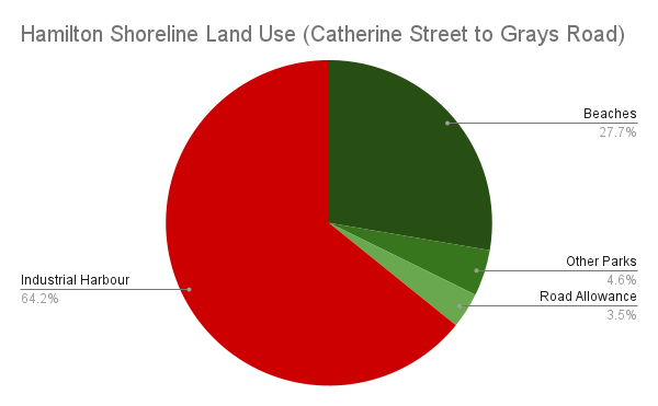
Over a third of the shoreline is strictly tied up in the piers and inlets of the industrial sectors. This whole stretch of shoreline between Catherine Street and Eastport Drive is what gave Hamilton its brand as a steel town, and may seem like land that is forgone as being locked away forever in heavy industrial use. But the recent sale of the Stelco Lands provides a major catalyst for redevelopment of these lands into modern industrial parks unlocking major public realm improvements.
Excluding the industrial port and the sand bar will tell you 3/4 of the shoreline is publicly accessible, and it’s increased as the city grows. Bayfront and Pier 4 Parks added a significant amount of public shoreline when they opened in 1993. Piers 5-8, as well as improvements in Macassa Bay, have slowly added a public urban edge to see the harbour in the last two decades.
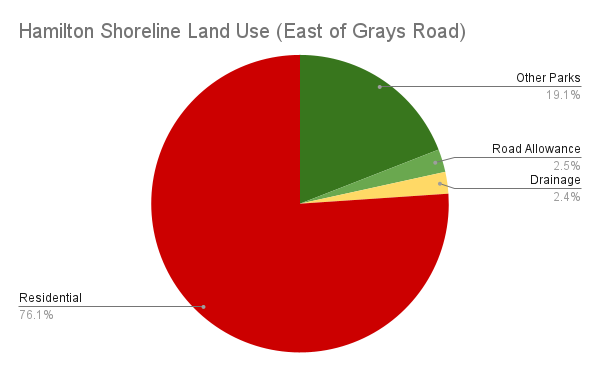
Conversely, most of Stoney Creek’s shoreline is taken up by residential lots. This has the potential to change as redevelopment occurs, but it requires dedication.
Notes:
- These numbers were obtained by tracing Hamilton’s shoreline using 2023 city orthoimagery. Unlike other datasets, it has not been refined based on parcel data. See Licensing and Disclaimers for more info.
- The shoreline may be subject to negligible fluctuations due to lake elevation, shoreline erosion / shifting due to other natural phenomena, human modifications (private developments, public infrastructure work, etc.), or the accuracy / vintage of the map imagery itself. It’s not precise, but accurate enough to portray the broad picture.
- Some shoreline length is accounted for by inlets and other channels that extend inland, and peninsulas hat extend out into the lake. While this may mean there is ‘1 kilometre of shoreline’, it may be only a few dozen metres as the crow flies between connecting points on the mainland.
- The east extent of Hamilton’s shoreline is extended to include part of Fifty Creek Conservation Area, a Hamilton Conservation Authority park. Some of this park technically extends into Niagara Region, but for practical purposes, it’s a contiguous area that’s “part of Hamilton”.
Open Data
This dataset is available in multiple formats through the Open Data Portal