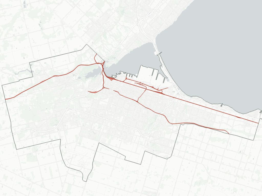
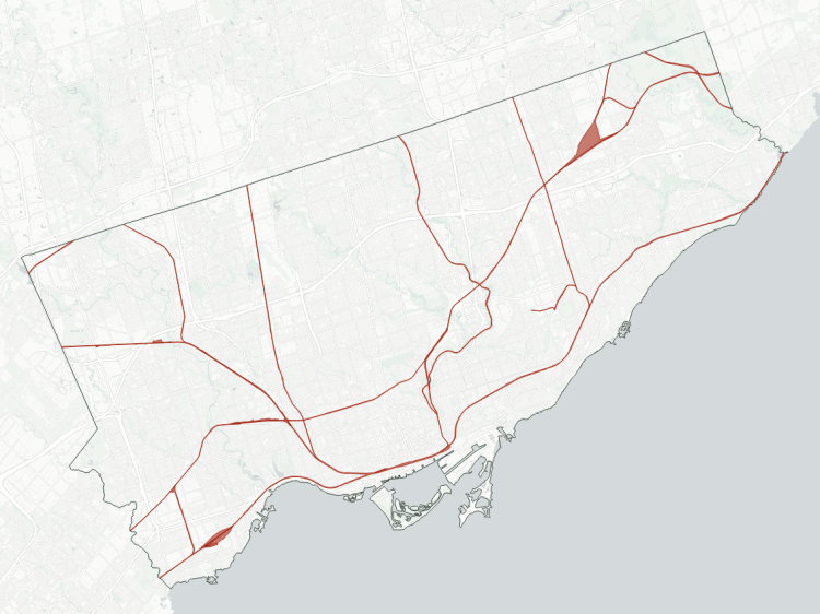
Railways have been major arteries feeding the heart of the Greater Toronto Area. Much of the West GTA’s history with railways is rooted in railways radiating out of downtown Toronto to other parts of southern Ontario, in order to deliver people and goods. Over the decades, the look of the network has changed a bit.
But whether a rail corridor carries freight or people, a common issue often gets overlooked: how they are long, restricted corridors that cut off access across, over or under them for large distances. This creates increased travel times for pedestrians and cyclists. Improved access across these corridors, and even parallel to them, can improve the city’s broader active transportation network. Furthermore, they often sever natural and open spaces in a similar manner, making it a double whammy on the public realm.
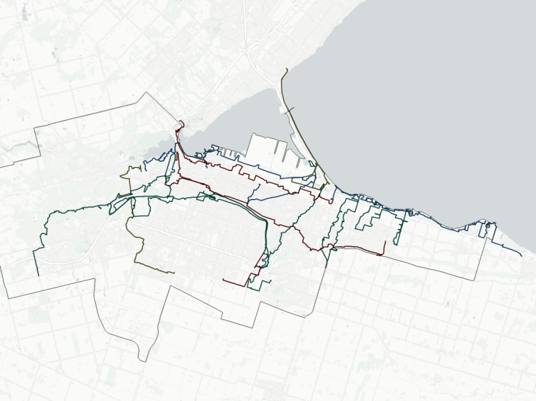
So like other metroscapes I explore, I have documented major corridors. Check out the specific corridors, stats and an interactive map below.
- Oakville Subdivision
- Halton Subdivision
- Weston / Guelph Subdivisions
- Galt Subdivision
- Hamilton / MacTier Subdivisions
- Owen Sound Subdivision
- Spurs
- Notes / Disclaimers
- Explore Railways in Other Cities
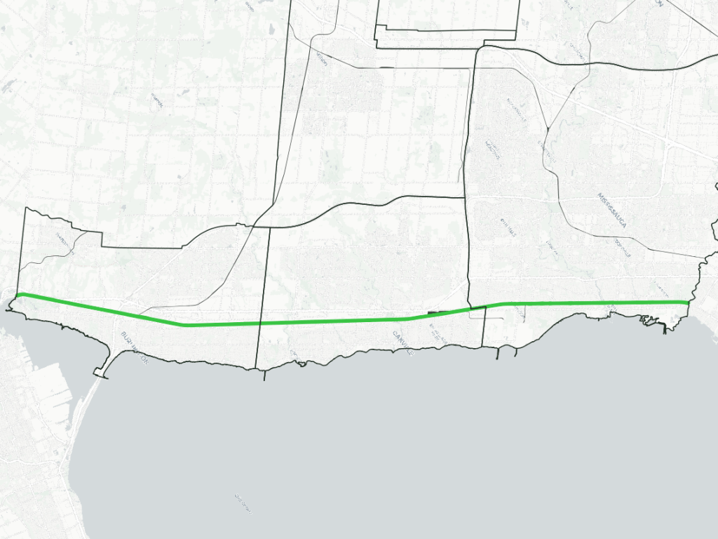
Oakville Subdivision
| Area | 140.5 ha |
| Length | 35.7 km |
| Average Width | 33 m |
| Tracks | 3 |
The Oakville Subdivision was the mainline for Canadian National (CN) into downtown Toronto, connecting to further lines onwards to Kingston and Montreal.
Built by the Grand Western Railway (GWR) in 1855, it spanned parallel to the west GTA’s shoreline to a triangular junction known as Bayview, where it met lines to Niagara and southwestern Ontario. GWR was absorbed by the Grand Trunk Railway (GTR) in 1882, which later became Canadian National (CN) in 1923.
The Oakville Sub was a main link between US border connections in Sarnia and Niagara Falls, and the St Lawrence Seaway. With the Toronto Bypass project completed in the 1950s, freight services were shifted to the Halton Sub in Burlington, and the importance of freight to the east continued to dwindle away. That said, there are still a number of freight customers along the line west of Clarkson Road.
The Oakville Sub was part of GO Transit’s original Lakeshore line when operations began in 1967, and it continued to grow as the GO line with the highest ridership and most frequent service. CN Passenger services were spun off to VIA Rail in 1977, and in addition to London/Windsor-bound trains, the line also is a link for Amtrak’s Maple Leaf service to New York.
With the need to expand services and take control of maintenance, the corridor was purchased in two segments by Metrolinx in 2012 and 2013, between Toronto and Burlington GO.
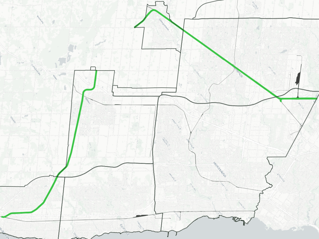
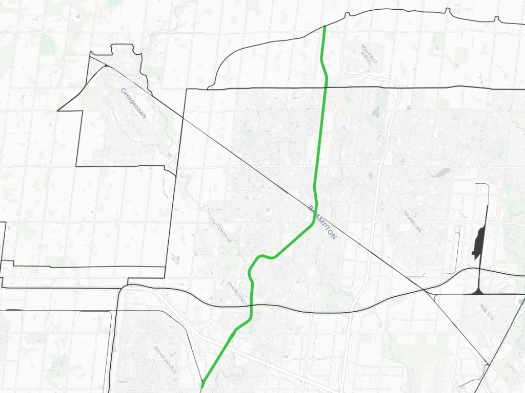
Halton Subdivision
| Area | 217.9 ha |
| Length | 52.9 km |
| Average Width | 41 m |
| Tracks | 2 |
The Halton Subdivision has some 19th century history, but the corridor as it’s designated today has a convoluted history. It’s best to break it up into three distinct sections:
- Burlington-Milton
- Georgetown-Bramalea
- Bypass
Section A was opened in 1876 by the Hamilton and North-Western Railway (renamed the Northern and North-Western Railway three years later). Crossing Section B at Georgetown, it continued northwards to Barrie and Collingwood. In 1888, GTR took a controlling interest, and it was eventually absorbed into CN in 1923. CN abandoned the section north of Georgetown in 1975.
Section B was built by the GTR in 1856, part of its mainline from Toronto through Georgetown to Guelph, Kitchener and London. Section C was built as part of CN’s Toronto Bypass project in the 1950s. Instead of going into downtown Toronto, freight traffic was split off south of Bramalea into York Region, connecting with new large freight yards, and carrying traffic onwards to Pickering, where it continued along the lakeshore.
Weston / Guelph Subdivisions
| Area | 16.6 / 5.1 ha |
| Length | 5.3 / 1.3 km |
| Average Width | 31 / 38 m |
| Tracks | 3 / 1 |
Though they only has small portions within the west GTA, the Weston and Guelph subdivisions are the remnant parts of GTR (and later CN’s) mainline from downtown Toronto. With the completion of the Toronto Bypass project, the Weston and Guelph Subdivisions ceased to be a critical mainline for freight traffic.
But in conjunction with Section B of the Halton Sub, these continued to be a critical passenger connection for VIA Rail and GO Transit service between Toronto and Guelph / Kitchener. VIA Rail was spun off as a new federal Crown corporation in 1977 to take over intercity passenger rail services from CN, and this included Toronto-Kitchener-London services.
GO Transit began operations to Georgetown in 1974, extended service west to Guelph briefly between 1990 and 1993, and restored service to Kitchener in 2011. Metrolinx bought the Weston Sub in 2009, and the Guelph Sub in 2011.
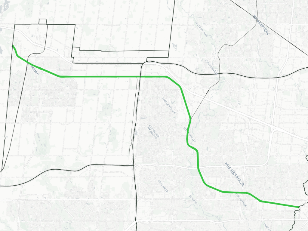
Galt Subdivision
| Area | 106.0 ha |
| Length | 36.1 km |
| Average Width | 29 m |
| Tracks | 2 |
The Galt Subdivision is part of CPKC’s main east-west route across southern Ontario. The sub comes eastwards down the escarpment into Milton, turns south through Mississauga’s Streetsville neighbourhood, and bending eastwards again south of the 403 into Toronto.
The line was originally built by the Credit Valley Railway in 1879 and opened in 1880, creating a route between Toronto and Galt (Cambridge). During the following four years, financial troubles led to a series of ownership changes that culminated in the line becoming part of CPKC’s predecessor, the Canadian Pacific (CP) Railway.
CP operated passenger trains along the line until 1971. However, unlike some other parts of the country, this service was not restored by VIA Rail Canada. GO Transit began offering train service for its Milton Line in 1981.
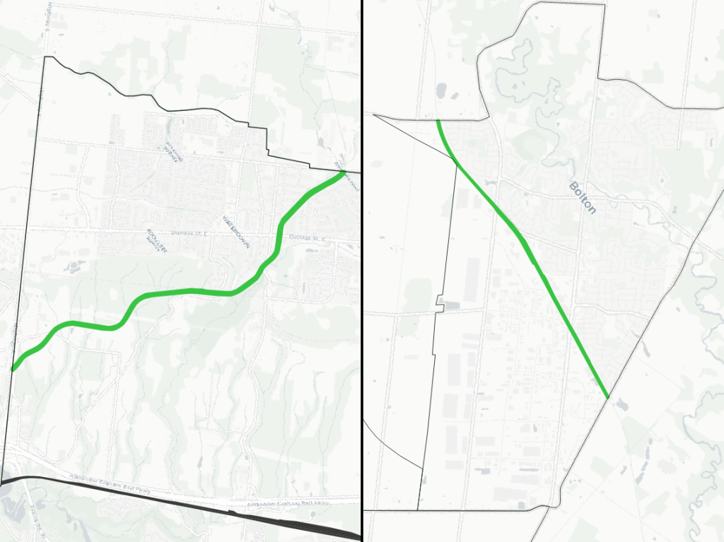
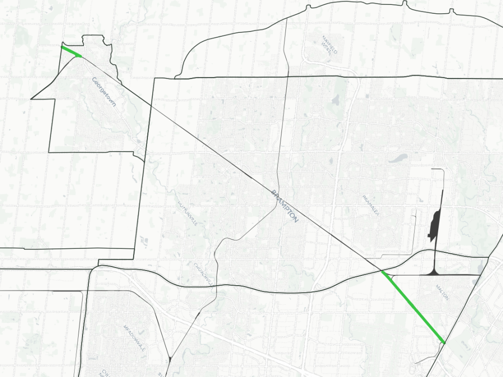
Hamilton / MacTier Subdivisions
| Area | 16.9 / 16.6 ha |
| Length | 5.7 / 5.1 km |
| Average Width | 30 / 33 m |
| Tracks | 1 / 2 |
Small sections of CPKC’s rail network nick the corners of the west GTA.
One is the Hamilton Sub, providing a connection between their east-west mainline at Campbellville, and their trackage towards Fort Erie and the US border. This is a single mainline that winds its way down the escarpment through Waterdown.
The other is the MacTier Sub, CPKC’s gateway to northern Ontario. This is mostly a double track through Bolton.
Owen Sound Subdivision
| Area | 52.5 ha |
| Length | 23.0 km |
| Average Width | 23 m |
| Tracks | 0 |
The Owen Sound Subdivision is…no more. It is currently abandoned, and slated to become a rail trail.
The line was originally built by the Credit Valley Railway in the 1870s. As with the Galt Sub, the line became part of the CP network four years later. Scheduled passenger trains operated on the line until 1970, and portions north fo Orangeville were abandoned in 1995.
In 2000, the Town of Orangeville purchased the remainder of the line from CP, with upper government funding assistance. Feright service was contacted out to support the remaining industrial businesses, and the Credit Valley Explorer tourist train also ran occassionally to offer pitcuresque views of the Forks of the Credit and Niagara Escarpment.
In December 2021, the Town ceased freight operations on the line. It was purchased by municipal governments in Mississauga, Brampton and Caledon (along with Peel Region), and will be converted into a rail trail.
Spurs
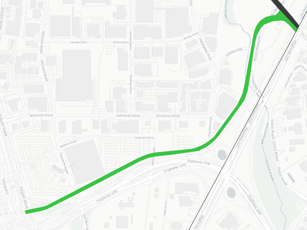
Pearson Spur
| Area | 4.6 ha |
| Length | 2.3 km |
| Average Width | 20 m |
| Tracks | 2 |
The Union Pearson Express began operating in 2015 as a dedicated rail link between, as the name suggests, Union Station in Toronto and Terminal 1 at Pearson Airport. While it mostly operates along the Weston Sub, it splits off within the West GTA west of Highway 427, and follows an elevated guideway to the Link Train.
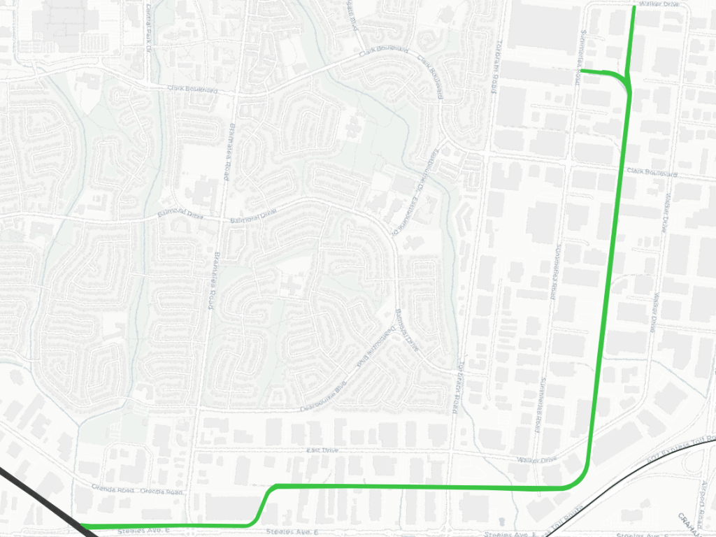
Torbram Lead
| Area | 8.4 ha |
| Length | 5.3 km |
| Average Width | 16 m |
| Tracks | 1 |
The Torbram Lead serves multiple businesses in Brampton’s industrial area between Torbram and Airport Roads. This area was nothing but farmland, but by 1968, a small lead existed to north of 2070 Steeles Avenue East. It is presumed to have been extended with subsequent industrial development.
Oakville / Lubricant Spurs
| Area | 6.3 / 8.4 ha |
| Length | 2.9 / 1.2 km |
| Average Width | 22 / 24 m |
| Tracks | 1 |
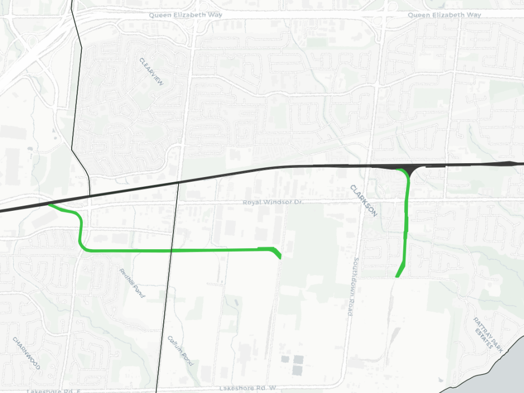
These two spurs serve the southwest industrial area of Mississauga. The Oakville Spur (likely named so as it branches off the Oakville Sub within the borders of Oakville) serves multiple businesses between Avonhead Road and Winston Churchill Boulevard. The Lubricant Spur branches off of the Clarkson Yard, and is dedicated to serving Petro-Canada’s Mississauga Lubricants Centre at 385 Southdown Road.
Hornby Spur
| Area | 15.3 ha |
| Length | 7.5 km |
| Average Width | 20 m |
| Tracks | 1 |
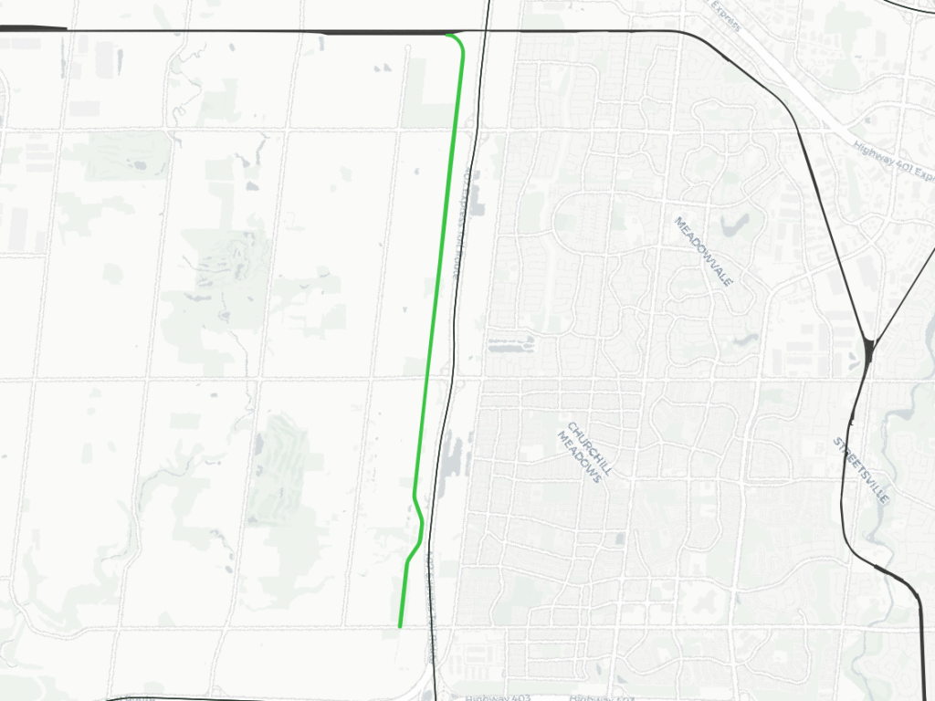
A long spur west of the 407, south of the Galt Sub, exists solely to service Hydro One’s Trafalgar Transformer Station at the 403/407 interchange. It’s hard to pin down an exact year, but it appears the station and the spur were constructed between 1966 and 1985.
Notes / Disclaimers
- This data was drawn interpretively based on orthoimagery, using the Railway Association of Canada’s Canadian Rail Atlas as a general reference. Some refinement was possible due to open parcel data from the City of Mississauga. Some interpretive refinements were made, and the exact extent of railway property may not be correct. Therefore this data is provided ‘as is’; please refer to additional disclaimers at the Open Data page.
- While this website advocates for greater active transportation access across and parallel to railways, they are private property and are dangerous places. DO NOT trespass on railways; over 100 Canadians are killed or seriously injured trespassing on or crossing railways each year. Remember that train time is anytime.
This dataset is available in multiple formats through the Open Data Portal