The Great Lakes are a feature that’s often taken for granted. Accounting for a fifth of the world’s fresh surface water, they provide drinking water, alter our weather, and offer a unique opportunity for recreation.
In the days before starting Metroscapes, I took long, undocumented, and random walks in Toronto. More times than not, I ended up at the shoreline, and more times than not, I did not plan on it. I gravitated to it subconsciously. There’s a body of research to suggest there are real human psychological connections to bodies of water.
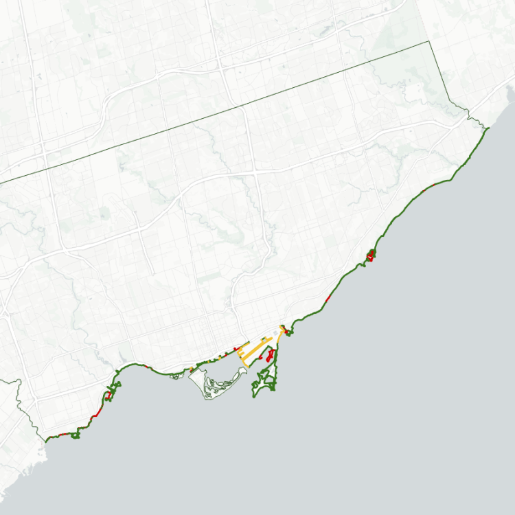
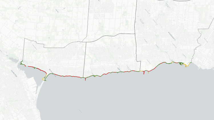
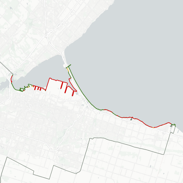
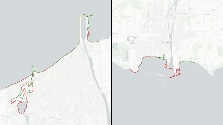
I’m not hung up on that, rather I take stock in the urban realm opportunities and benefits; publicly accessible shorelines make for great parkland. As the crow flies, a city’s borders may be fraction of the actual length of its shoreline, as every inlet and peninsula contributes to a lengthened opportunity to enjoy the waterfront.
So it’s important to take stock of the ownership and access to the shoreline. In an ideal world, a city’s shoreline is 100% open public access, regardless of use. It is an asset and a treasure to be shared. Admittedly, it would be nearly impossible to achieve 100%, but it is a worthy goal to work towards.
Notes:
- Many of these numbers were obtained by drawing low-resolution lines along Toronto’s shoreline using Google Maps, and may be subject to negligible fluctuations due to lake elevation, shoreline erosion / shifting due to other natural phenomena, human modifications (private developments, public infrastructure work, etc.), or the accuracy of the map imagery itself. It’s not precise, but accurate enough. See licensing and disclaimers for more details.