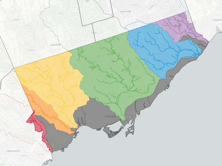
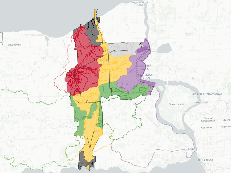
Watersheds in the North Greater Toronto Area are unique given that the region straddles the Oak Ridges Moraine. This creates a major split between two whole basins.
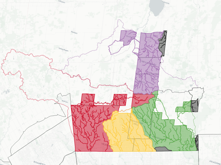
75% of the region (enveloping all of urban Vaughan, Richmond Hill and Markham) is covered by the Humber, Don and Rouge Rivers. The Humber and Rouge Rivers in particular have significant upstream catchments (62% and 37% of their total catchments north of Toronto, respectively), characterized by a fan of small streams and large ponds. By the time they cross Steeles Avenue, they have cumulated into major watercourses with wide valleys.
Another 21% of the region (Aurora, Newmarket, East Gwillimbury and Bradford) drains north instead into the Holland River and Lake Simcoe. The divide between it and the lower 3 watersheds lies roughly north of Bloomingdale Road / 15th Sideroad, and separates runoff between a southern direct ~60-80 kilometre ride to Lake Ontario, and a 1,230 km circuit via the Holland River, Lake Simcoe, Severn River, Georgian Bay, and Lakes Huron / St Clair / Erie.
The remaining 4% is divided between 5 other watersheds, all with an urban catchment under 1,000 hectares: Highland, Petticoat, and Duffins Creeks in the Lake Ontario basin, and the Black and Maskinonge Rivers in the Lake Simcoe basin.
The map below shows the boundaries of these watersheds. Overtop of that, I have mapped the numerous watercourses within them.
This is a work in progress. See a mapping error? Have a name to put to an unnamed tributary? Please feel free to send me comments.
Notes and Disclaimers
- This data was created with the support of digital terrain information from the Ontario GeoHub, as well as watershed data from Toronto and Region / Lake Simcoe Region Conservation Authorities. This data is provided under their owners’ respective open data licences.
- This is interpretive and not based on a full qualified assessment of surface and groundwater resources. Therefore this data is provided ‘as is’; please refer to additional disclaimers at the Open Data page.
- While this page advocates for greater public access, not all watercourses are publicly accessible. Please observe all signage respecting access and refrain from travelling off established trails, for your health and safety, as well as the integrity of local ecosystems.
Open Data
This dataset is available in multiple formats through the Open Data Portal

Watersheds in Other Cities