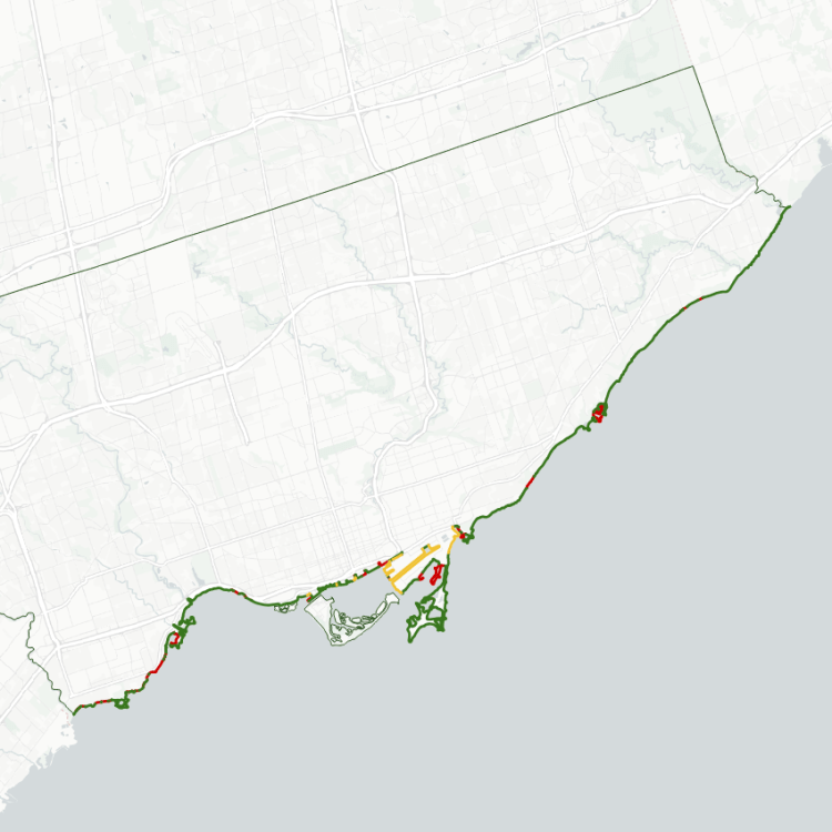
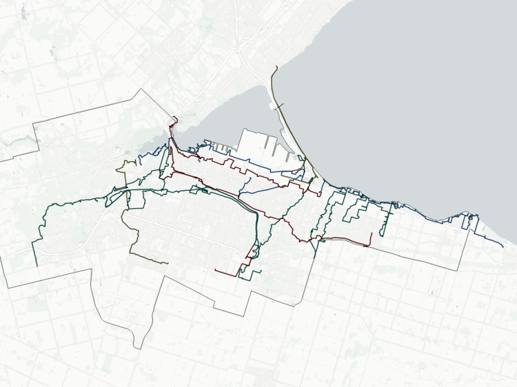
Niagara Region is unique from the other shorelines I have analyzed to date, as the urban areas span not just Lake Ontario, but Lake Erie as well.
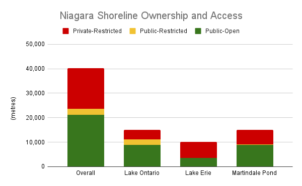
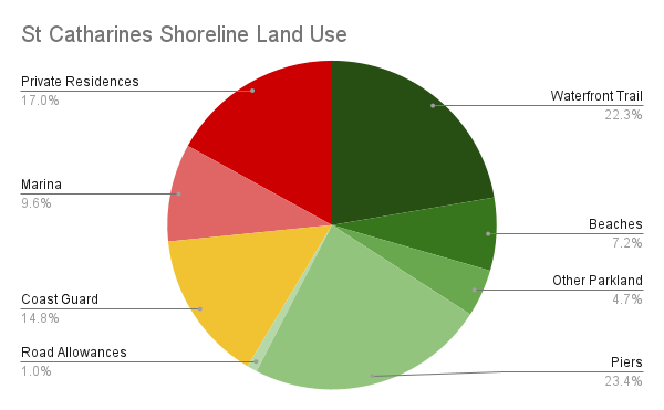
On the Lake Ontario side, the urban area of focus is contained within St Catharines. As the crow flies, this shoreline is just under 8 kilometres. But piers, spits and other minor wiggles nearly double the water’s edge to 15 kilometres. Just over a third of this public parkland, divided between beaches, waterfront trails and other green spaces. The piers at Twelve Mile Creek and the east spit flanking the Welland Canal accounts for another quarter of the shore by themselves. The west spit along the Welland Canal is another 15%, and is restricted for use by the Canadian Coast Guard. The remaining 27% is private, split between the St Catharines Marina and private residences.
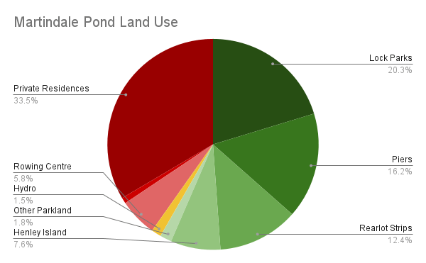
I have also analyzed a subset of this side of Niagara by breaking down the shoreline around Martindale Pond, which is the outflow of Twelve Mile Creek. Normally I would analyze this like a riverbank, but given how there’s inlets and islands, that methodology doesn’t work. So I characterize it like a shoreline.
Just under 60% of it is public, however, I feel like this warps the real quantity of parkland available. Only half of it is truly deep parkland, split between the public portion of Henley Island, as well as Royal Henley and Rennie Parks. The other half is in shorewalls and piers leading out from the headpond, strips in behind some residences, and the edges of a couple roads. One third of the shoreline is private residences, and the remaining 8% is a marina, hydroelectric plant and the Henley Island Rowing Centre.
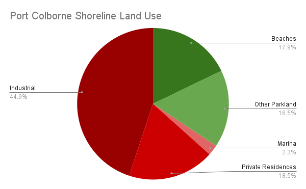
On the Lake Erie side, the focus is the urban boundaries of Port Colborne. It’s 6 kilometres as the crow flies, but the bend of Gravelly Bay and inlet to the Welland Canal extend this to 10 kilometres. Again, a third of this is public parkland in the form of beaches and other green spaces. But there’s nothing else public on top of that. A marina and private residences take up 21% of the shore. The remaining 45% is industrial lands at the Welland Canal, with mills and silos on the west side, and Snider Docks on the east side.
Other green and blue edges exist in Niagara, along various large rivers, canals, lakes and reservoirs across the the region. This is a forthcoming area of further analysis.
Notes:
- These numbers were obtained by hand-drawing lines along the shore using the latest available open orthoimagery. No open parcel data was available to refine the data, so some interpretive liberties were taken. See Licensing and Disclaimers for more info.
- The shoreline may be subject to negligible fluctuations due to lake elevation, shoreline erosion / shifting due to other natural phenomena, human modifications (private developments, public infrastructure work, etc.), or the accuracy / vintage of the map imagery itself. It’s not ultra-precise, but accurate enough to portray the broad picture.
- Some shoreline length is accounted for by inlets and other channels that extend inland, and peninsulas that extend out into the lake. While this may mean there is ‘1 kilometre of shoreline’, it may be only a few dozen metres as the crow flies between connecting points on the mainland. Some liberties were taken to exclude some breakwaters and groynes that do not add value to public access.
Open Data
This dataset is available in multiple formats through the Open Data Portal