Exploring hydro corridors was inspired by The Meadoway in Toronto, and exploring the hydro corridors there. I’ve since expanded it to other cities I walk in.
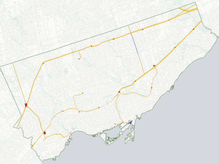
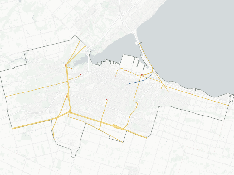
Toronto, the Tri-Cities and Hamilton have a multitude of different corridors criss-crossing all over the place. Guelph, on the other hand, basically just has one: a single 16 kilometre spine from south to north, covering 50 hectares. Technically, there’s a couple branches, but they don’t amount to much within the official city border.
Having only a single corridor shouldn’t discount it as another opportunity for parkland and recreation. This could be a critical spine to a broader network.
Notes and Disclaimers
- This data was created with the support of roadway, administrative boundary, and property parcel data from Guelph’s Open Data Portal, made available under the City of Guelph Open Government Licence v1.0 (refer to the Metroscapes Open Data changelog for dates).
- This is interpretive and not based on official property ownership or right information from any utility or government entities. Some utility corridors are not plainly defined by property boundaries, and may cross or abut private property, roadways and railways. Some interpretive liberties were taken. Therefore this data is provided ‘as is’; please refer to additional disclaimers at the Open Data page.
- While this page advocates for greater public access, utility corridors are private property and this page does not suggest they are all publicly accessible. Please observe all signage respecting access and activities permitted within these corridors. Remember that these are high voltage power lines, and they can be dangerous.

Open Data
This dataset is available in multiple formats through the Open Data Portal