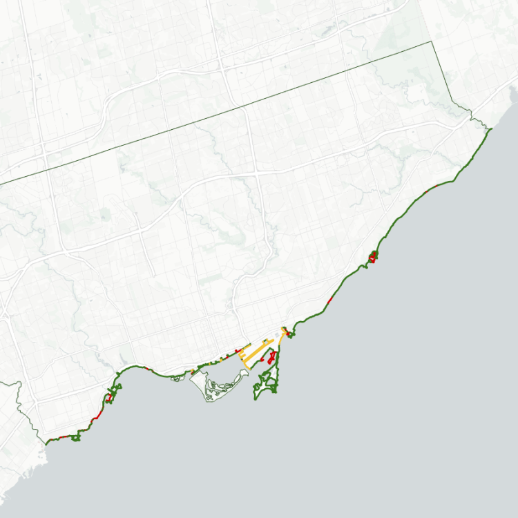
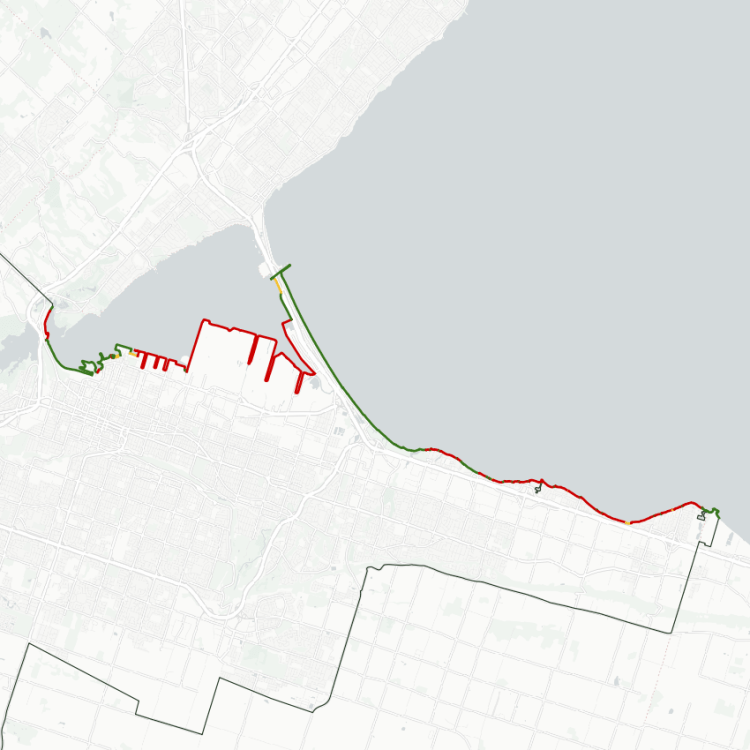
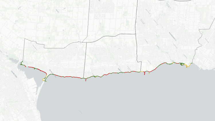
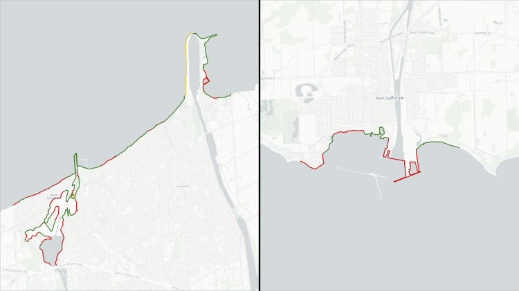
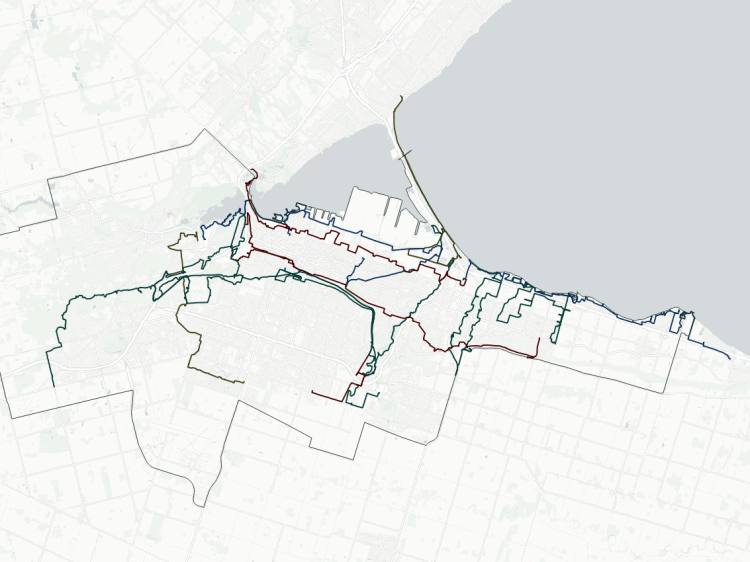
Durham Region has an expansive shoreline along Lake Ontario, and my analysis extends from the Rouge River in the west, to a rural road just outside of Newcastle in the east. As the crow flies, this shoreline is almost 47 kilometres. Piers and inlets extend this by 25% to 58 kilometres.
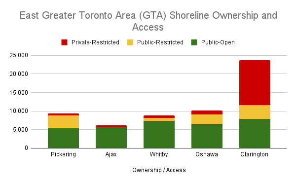
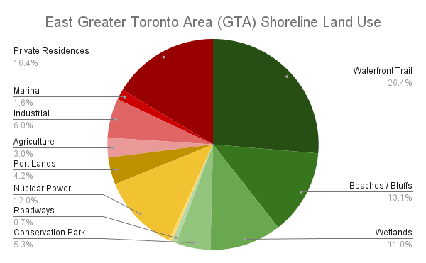
Over half of this is public parkland, divided between beaches, waterfront trails, wetlands and provincial parks / conservation areas. Another 18% is publicly-owned but restricted land, most of which is alongside two nuclear power plants, and the remainder is in the Port of Oshawa as well as two water supply intakes. The last quarter of it is private restricted lands. 6% is just the St Mary’s Cement Quarry, almost 5% is agricultural land and marinas, and the remainder is private residences.
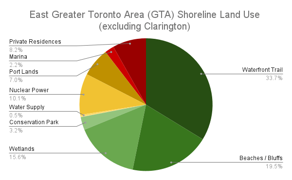
Clarington is a very stretched portion of the shoreline, with many rural industrial and agricultural land uses, so excluding that portion of the Region paints a rosier picture, with 72% of the lands being public. Picking Nuclear Generation Station and the Port of Oshawa still eat up 17% of the water’s edge, with the remaining 8% consisting of private residences and marinas.
Notes:
- These numbers were obtained by hand-drawing lines along the shore using the latest available open orthoimagery. No open parcel data was available to refine the data, so some interpretive liberties were taken. See Licensing and Disclaimers for more info.
- The shoreline may be subject to negligible fluctuations due to lake elevation, shoreline erosion / shifting due to other natural phenomena, human modifications (private developments, public infrastructure work, etc.), or the accuracy / vintage of the map imagery itself. It’s not ultra-precise, but accurate enough to portray the broad picture.
- Some shoreline length is accounted for by inlets and other channels that extend inland, and peninsulas that extend out into the lake. While this may mean there is ‘1 kilometre of shoreline’, it may be only a few dozen metres as the crow flies between connecting points on the mainland. Some liberties were taken to exclude some breakwaters and groynes that do not add value to public access.
Open Data
This dataset is available in multiple formats through the Open Data Portal