As alluded to in my previous blog post, GIS is enabling me to create new projects and types of analysis. One of the first new projects, which I am publishing today, is “Riverbanks“. This is an analysis of the ownership and public access to each side of a major river.
This has been a long term goal of mine ever since I moved out of Toronto and expanded Metroscapes to the Tri-Cities. I wanted to expand my first (and probably still best) project, the Toronto Shoreline. It’s the closest analogue.
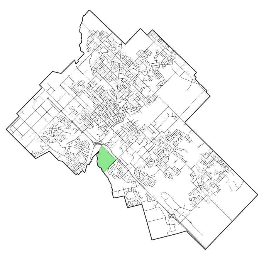
And the first city I am doing this project for is Guelph, as it is currently the smallest Metroscapes city. This makes it a good place to practice or learn GIS skills, form some standards, problem solve, and then scale up.
Problem one: the coastline paradox. The “length” of a shoreline (or frankly, any other geographic feature you can measure) wmill vary with how much detail or generalization you use. I used less cartographic generalizarion in Toronto because it has ‘longer’ points of shoreline (e.g. peninsulas) that (arguably) increase public space.
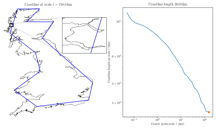
Courtesy Wikimedia user Tveness
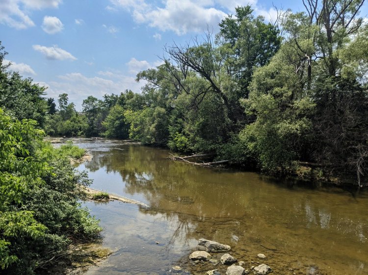
But it does not work the same way or at the same scale on a river. Toronto’s peninsula parkland can stretch out from the mainland for hundreds of metres, whereas Guelph’s two rivers are maybe 20 metres wide. 3 kilometres of public shoreline over a 16 hectare area is not the same as 170m of riverbank in a 0.16 hectare tailwater. There’s just not as much benefit.

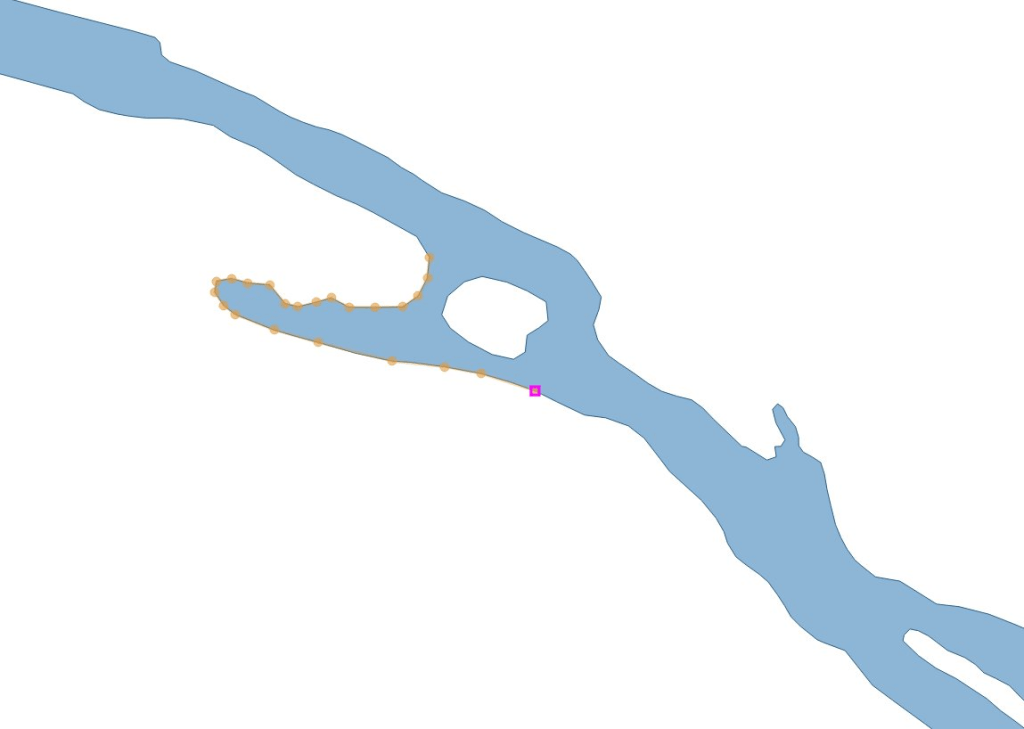
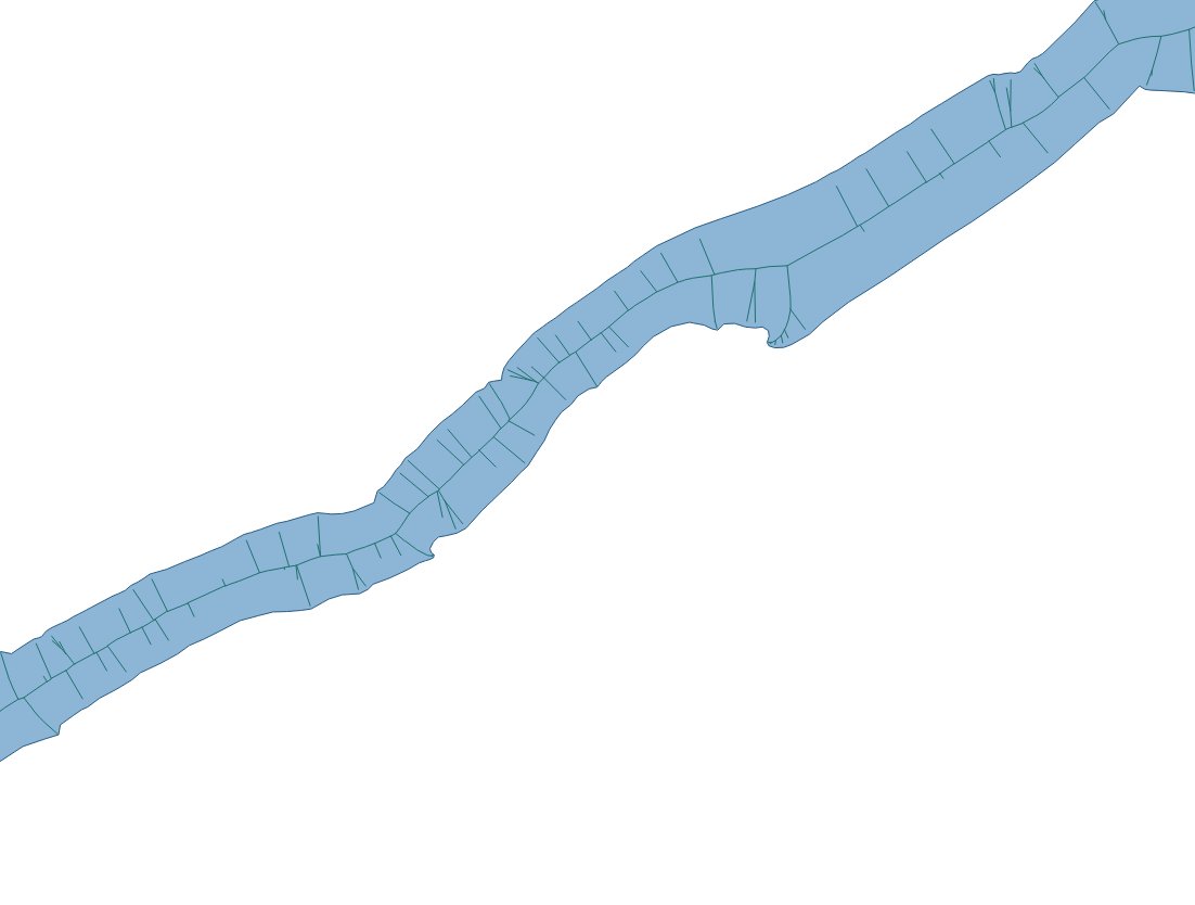
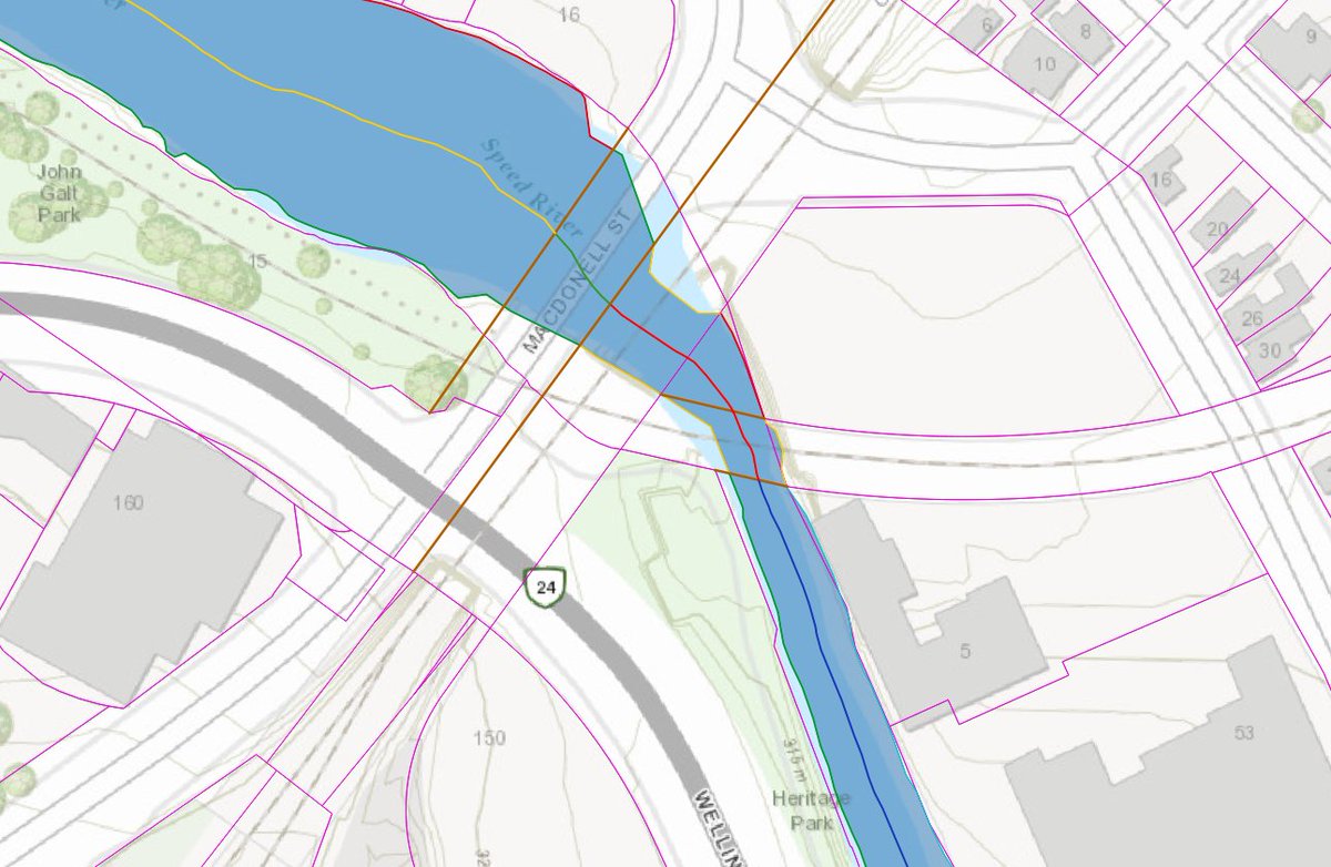
So I needed some other way to measure a river. I used river polygons downloaded for free from the conservation authority and generated a centreline within it with GIS. Then I broke up the banks and the river centreline using parcel data to create somewhat precise segments. Creating these and obtaining their lengths is relatively quick work thanks to tracing tools and table functions in GIS. Then I joined two tables to connect a bank segment to a corresponding centreline segment.
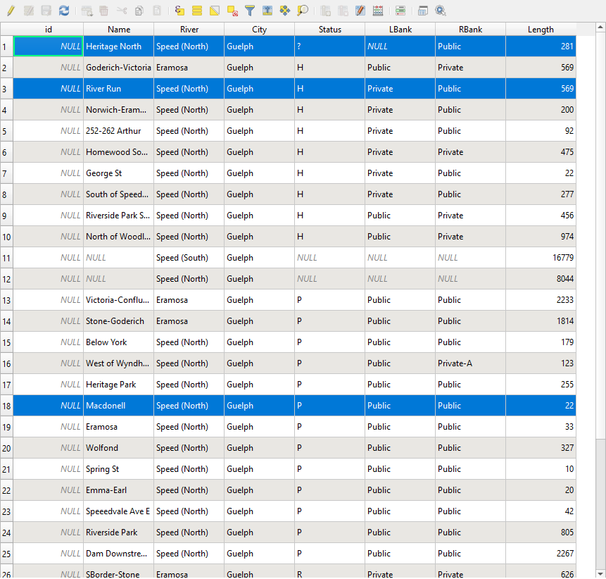
After much slicing and dicing, and adding in metadata, I created the Guelph Riverbanks project. You can now see what stretches of river (i.e. a characterization of both banks) have public access, and a breakdown of each bank in terms of a category.
Throughout my research in putting this together, I came across a couple interesting backstories that may bring more of Guelph’s riverbanks into the public realm.
Dolime Quarry
For some time, there has been a big divot in Guelph’s west perimeter. This is the Dolime Quarry, a limestone pit bounded by the Speed River, College Avenue and Highway 6. Opened in mid 1850s, this was a major source of building material for many of Guelph’s historical structures, but it technically operated within neighbouring Guelph-Eramosa Township.
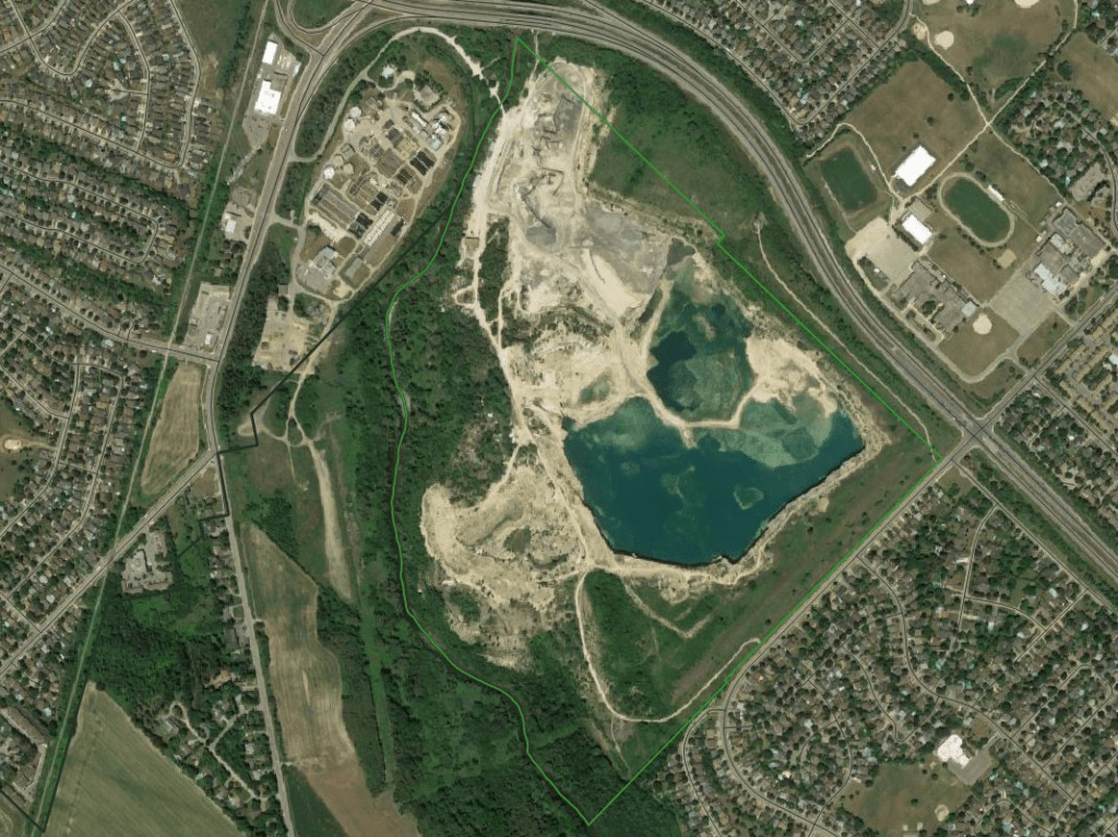
In 2002, the City began investigating and raising concerns about the quarry’s impact on local groundwater, the City’s drinking water source. A few years later, evidence emerged that it was a significant threat, and with that, the City successfully appealed a provincial water taking permit needed to operate the quarry in 2014.
The City and the quarry owner then negotiated an agreement to convert the quarry into a residential area over the next few years. A ministerial zoning order to implement the agreement was granted on December 6, 2021, and as of New Years Day 2022, the quarry was annexed to become part of the City of Guelph.
I’m less interested in this becoming a residential neighbourhood, and more interested in it becoming a publicly accessible riverbank and an enhanced riverine valley area. An environmental impact assessment will be done to create a baseline inventory and help set the minimum bounds for protection. I’m hopeful that this will create a fantastic strip of parkland for people and nature.
Sources: City of Guelph, Guelph Historical Society
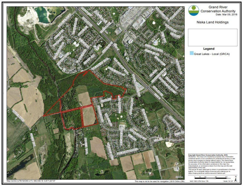
Niska Lands
I stumbled upon and gathered much of this information thanks to newspaper articles by Cameron Shelley.
You can find more details here at his website: guelphpostcards.blogspot.com
In 1948, Horace Mack purchased patch of land north of Niska Road and east of the Speed River, municipally know as 308 Niska Road. Mack had a passion for birds, waterfowl in particular, and it was here he set up the Niska Waterfowl Sanctuary.
He passed away in 1959, and after a decade of operations, it was facing financial trouble. So naturally, the Ontario Waterfowl Research Foundation purchased the land in 1961 and turned it into the Kortright Waterfowl Park. It became popular both as a park and a research centre. But as popular as it was, the Foundation still couldn’t keep the place afloat, and went looking for buyers in 1975.
At that point, the Grand River Conservation Authority came into the picture. One may think it was all for conservation purposes, but in reality, the authority already held lands in the area for a potential dam (which would require a large headphone in behind it). They purchased the land in 1975, securing 47 hectares in addition to the 17 hectares they already owned around it for this potential future dam. In the meantime, they leased it back to the Niska Wildlife Foundation to operate the park.
But nothing ever came of the conservation authority’s original plans. After completing an updated water management study using updated hydraulics, the idea for a dam at Niska was ditched. The Kortright Waterfowl Park continued operations, but facing decreased attendance and mounting bills, the park closed for good in 2005, and the Foundation’s lease was terminated in 2015.
Over the past few years since, the conservation authority has picked away at removing buildings, infrastructure and other remnants of the park that once was. The debris and disrepair makes it hazardous, and so it remains closed to the public. Also during this time, the city was reviewing their land use planning, and some of the eastern portions of its Niska Lands were marked for potential new residential development.
This triggered an appeal by a member of the public, and resulted in a settlement between the conservation authority, the city and the appelant in March 2018. As part of the settlement, the lands must have a management plan with public input (which includes a dedicated webpage to provide updates), and which may include a trail system along the east bank of the Speed River and the lower reach of Hanlon Creek.

Hi Trevor – did you ever check out http://www.panampath.com and accesspath.ca and see some of the other ways we were scanning trails.
dev
LikeLike
I like the archive, that’s great. I can’t get the access path site/app to work, it keeps taking me to Rouge Beach?
LikeLike