Guelph has two major rivers that carve the city into three regions. The Speed River enters the northeastern corner shortly after coming out of the Guelph Dam. Halfway through the city, it’s joined by the Eramosa River from the southeast. Together, the combined flows continue as the Speed River to the southwest.

Overall, public access to the riverbank is pretty good if you look at it on a reach basis (i.e. looking at both banks together along a stretch of water). 90% of all three rivers is accessible from at least one side. Half of the completely restricted length is on the very south border of the city, and a quarter of that is earmarked for public access on one side in the future.

Looking at each bank separately, the length of public riverbank goes down to 67%, with another 8% in private hands, but which allows public access. Much of remaining riverbank (22%) is privately held and restricted, and a small amount (3%) is publicly held and restricted.

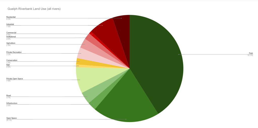
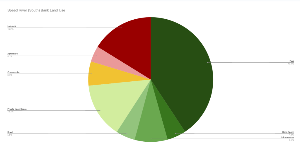
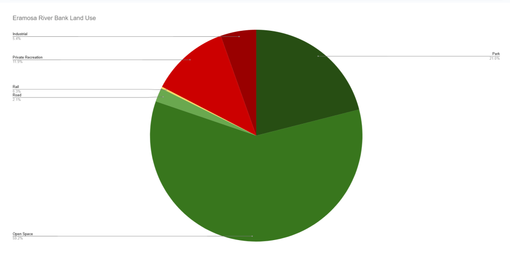
As you’d expect, much of the publicly owned and accessible riverbank is part of formal parks and open spaces, with a smaller amount consisting of roads, as well as the city’s wastewater and waste management facilities. A sliver of public-restricted banks are under rail lines, but most of the bank in that category is tied up in conservation lands that may have trail access in the future. Another 8% is privately held but publicly accessible open space, mostly split between two properties on the far north and south of the Speed River.
Looking at private lands, 5.2% consists of residential lots backing onto the river, and they aren’t likely to go anywhere anytime soon. 7.6% is industrial uses, a majority of which is tied up at the Dolime Quarry, which has closed operations and will likely be converted to a residential subdivision with a public riverbank in the future. The remaining 9% is spread out amongst other uses.

Notes:
- Much of the mapping is built off of information made available by the Grand River Conservation Authority, and trimmed with public parcel data from the City of Guelph. See licensing and disclaimers for more information.
- Land on the west banks of the very northern and southern Speed River are technically outside of the City of Guelph’s urban boundary, but are included for consistency. It’s also practical that a Guelph resident / visitor could easily enjoy both banks.

Open Data
This dataset is available in multiple formats through the Open Data Portal

